 Restoration / Architecture · Design and Construction
Historic City Centre · ANTAKYA, HATAY
District 4, Parcels 2060–2064 — Measured Survey + Restitution + Reconstruction Project
The project covers the measured survey, restitution and reconstruction of the traditional residential complex on parcels 2060 and 2064 in District 4. The survey documented the ground floor, attic, roof, elevations, sections and the details of the original ceilings, together with the building materials and traces of damage.
- Location
- District 4, Parcels 2060–2064
- Typology
- HOUSE
- Project type
- MEASURED SURVEY + RESTITUTION + RECONSTRUCTION
- Status
- SEVERELY DAMAGED · MEASURED SURVEY, RESTITUTION AND RECONSTRUCTION COMPLETED
- Year
- 2025
About the Project
The project covers the measured survey, restitution and reconstruction of the traditional residential complex on parcels 2060 and 2064 in District 4. The survey documented the ground floor, attic, roof, elevations, sections and the details of the original ceilings, together with the building materials and traces of damage.
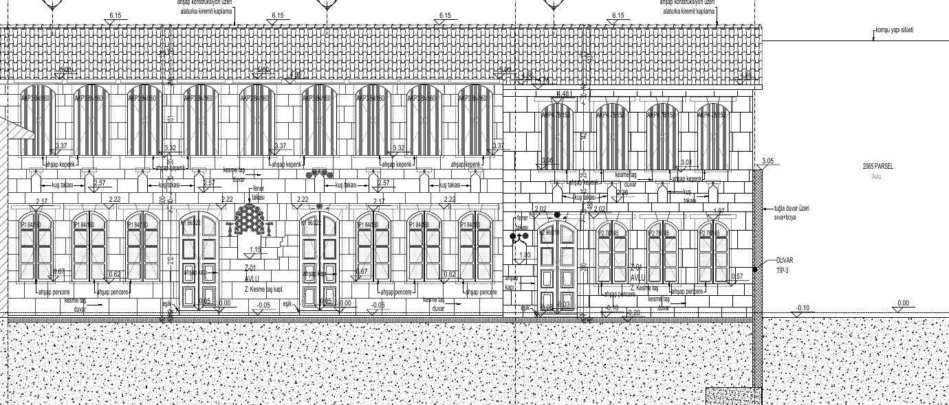
The restitution stage addressed the continuity between the two parcels, the sequence of rooms opening onto the courtyard, the timber ceilings and floors, the arched openings, the ashlar facade order and the hipped roof. The reconstruction project turns this data into an integrated architectural composition compatible with traditional materials and building techniques.
Urban Context
Parcels 2060 and 2064 in District 4 form a traditional residential whole that developed along Şimşek Çıkmazı in the Antakya Historic City Centre and opens onto a shared courtyard. The building is part of the dense fabric formed by Gali Konağı on parcel 2056 and the neighbouring parcels 2061, 2063, 2065, 2075, 2076 and 2080. The long street elevation, the linear sequence of rooms joining the two parcels, the courtyard entrances and the existing trees form the principal context of the project decisions.

The Project in Numbers
District 4, Şimşek Cul-de-sac
Ground floor and attic
Measured survey, restitution and reconstruction
Facade, courtyard and interior
Project Process
Measured Survey — Documenting the Existing Condition
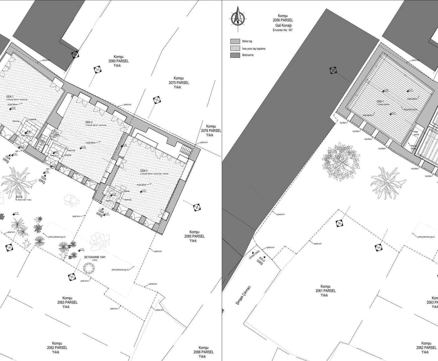
The measured survey documents the ground floor, attic and roof planes of the buildings on parcels 2060 and 2064 in their shared parcel relationship. The sequences of rooms, courtyard entrances, boundaries with neighbouring buildings, floor levels and differences in material are read within a single drawing system.
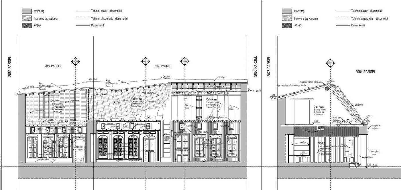
The elevations and sections distinguish the stone masonry walls, timber cladding, arched openings, roof deformations and inferred building traces; the geometry of the original timber ceiling was measured and recorded separately.
Selected plans and existing-condition drawings from the measured survey sheet
BasisOn-site measurement · material and damage assessment · readings of neighbouring buildings and the parcel
Restitution — Reading the Original Configuration
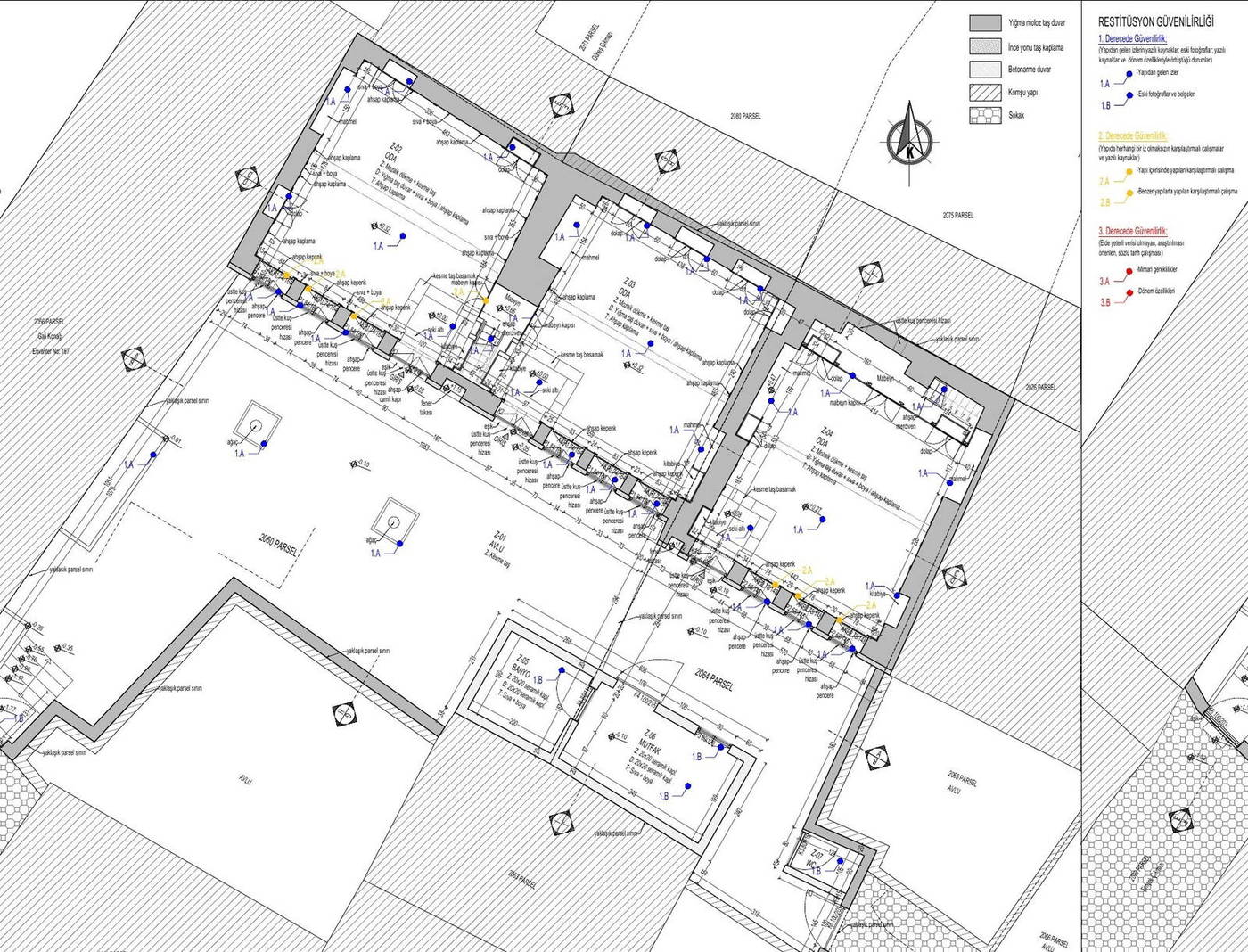
The restitution assesses the building traces documented in the measured survey together with archive photographs and the architectural character of the period. The sequences of rooms opening onto the courtyard on parcels 2060 and 2064, their internal circulation and the use of the attic are reread as a single residential whole.
The ashlar facade, arched timber joinery, bird niches, timber shutters, original ceiling ornament and alaturka tile roof are the basic components of the restitution decisions, each marked with its degree of reliability.
Plan and elevation decisions from the restitution sheet
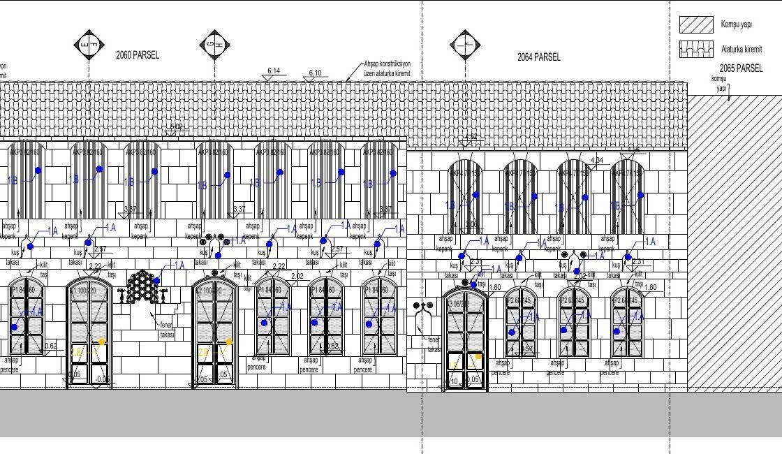
BasisSurvey data · archive photographs · building traces · period comparisons
Reconstruction — Rebuilding the Whole of the Building
The reconstruction project rebuilds the spatial continuity between the two parcels defined in the restitution, together with current building-safety requirements. The rooms, kitchen and wet spaces are arranged around the courtyard, and the attic and external circulation are resolved in keeping with the original scheme.
The stone masonry walls, ashlar facing, timber floors and ceilings, arched timber joinery and hipped roof clad in alaturka tiles together reproduce the building’s street silhouette and its traditional material character.
Selected plans and elevations from the reconstruction project
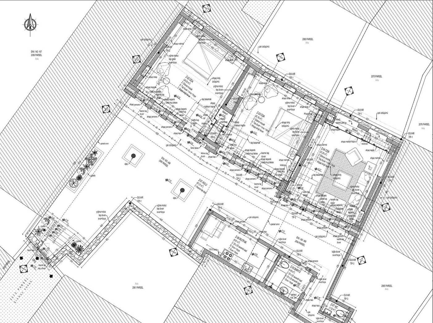
BasisRestitution decisions · the original plan scheme · traditional material and building technique
Project Sheets
Measured Survey and Restitution — Building Traces
Selected plan, roof and ceiling drawings reaching from the existing condition to the original configuration
- MEASURED SURVEY — GROUND FLOOR
- MEASURED SURVEY — ROOF PLAN
- ORIGINAL TIMBER CEILING
- RESTITUTION — ROOF PLAN
Reconstruction — Plans and Elevations
Floor, roof and elevation drawings of the whole courtyard house to be rebuilt
- GROUND FLOOR PLAN
- ATTIC PLAN
- ROOF PLAN
- FRONT ELEVATION
Project Team
- Yonca Yılmaz Çelebi
M.Arch · Conservation Specialist - Burcu Özlüoğlu
Architect - Eda Yabancı
Conservator
Method and Sources
The sequence followed in this file — documentation, diagnosis, evidence-based restitution, repair with minimum intervention — is the established method of the conservation literature. Intervention decisions were taken on the principles that repair must not begin before the cause of damage has been diagnosed, and that the degree of intervention rises from consolidation towards reconstruction only as far as necessity requires. For the theoretical framework see Zeynep Ahunbay, Tarihi Çevre Koruma ve Restorasyon (YEM Yayın, 2009); for the principles, the Venice Charter (1964), the Nara Document on Authenticity (1994) and Turkish Law No. 2863 on the Conservation of Cultural and Natural Property.
Services applied in this project
Related projects
View the project in presentation format
The submitted drawings, process account and typology cards for this parcel are available at full resolution in the horizontal presentation on the site.