 Restoration / Architecture · Design and Construction
Historic City Centre · ANTAKYA, HATAY
District 5, Parcel 1145 — Reconstruction Project
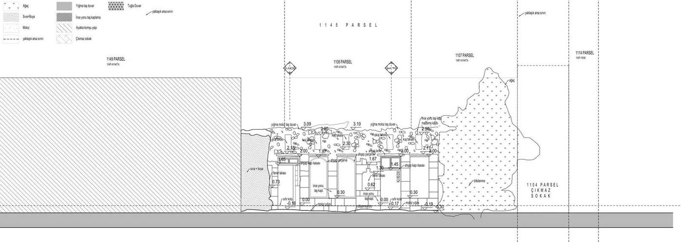
The project covers the measured survey, restitution and reconstruction of the building. The measured survey of the surviving parts and the building traces still legible in the collapsed parts are assessed together with photographs, measurements and archival research to form the restitution decisions, and the reconstruction projects are prepared in the light of the resulting data.
- Location
- District 5, Parcel 1145
- Typology
- HOUSE + COMMERCIAL
- Project type
- RECONSTRUCTION
- Status
- SEVERELY DAMAGED · MEASURED SURVEY COMPLETED
- Year
- 2024
- Scales
- 1/500 · 1/200 · 1/100 · 1/50
- Approving authority
- Hatay Regional Board for the Conservation of Cultural Property
About the Project
The project covers the measured survey, restitution and reconstruction of the building. The measured survey of the surviving parts and the building traces still legible in the collapsed parts are assessed together with photographs, measurements and archival research to form the restitution decisions, and the reconstruction projects are prepared in the light of the resulting data.
Urban Context
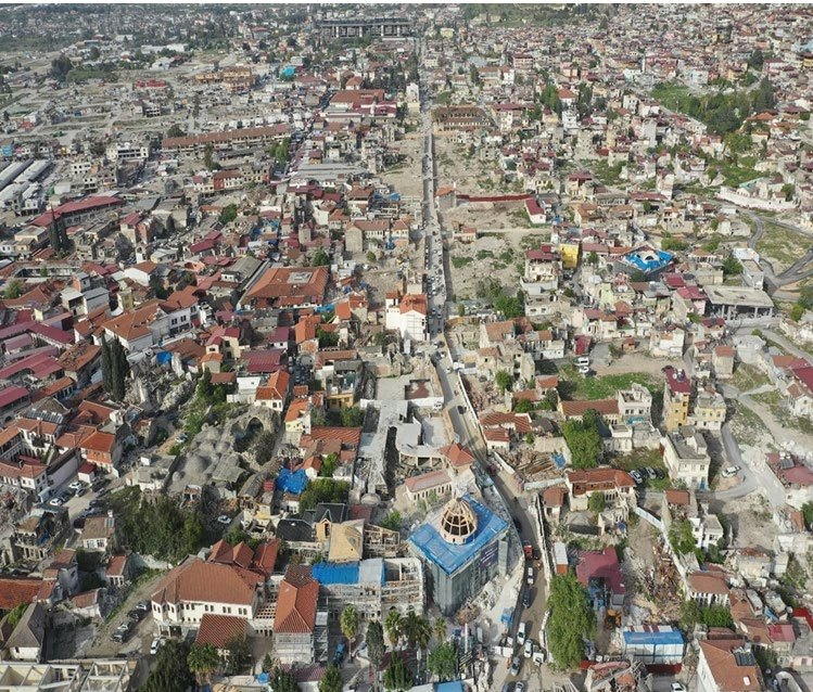
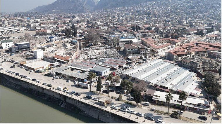
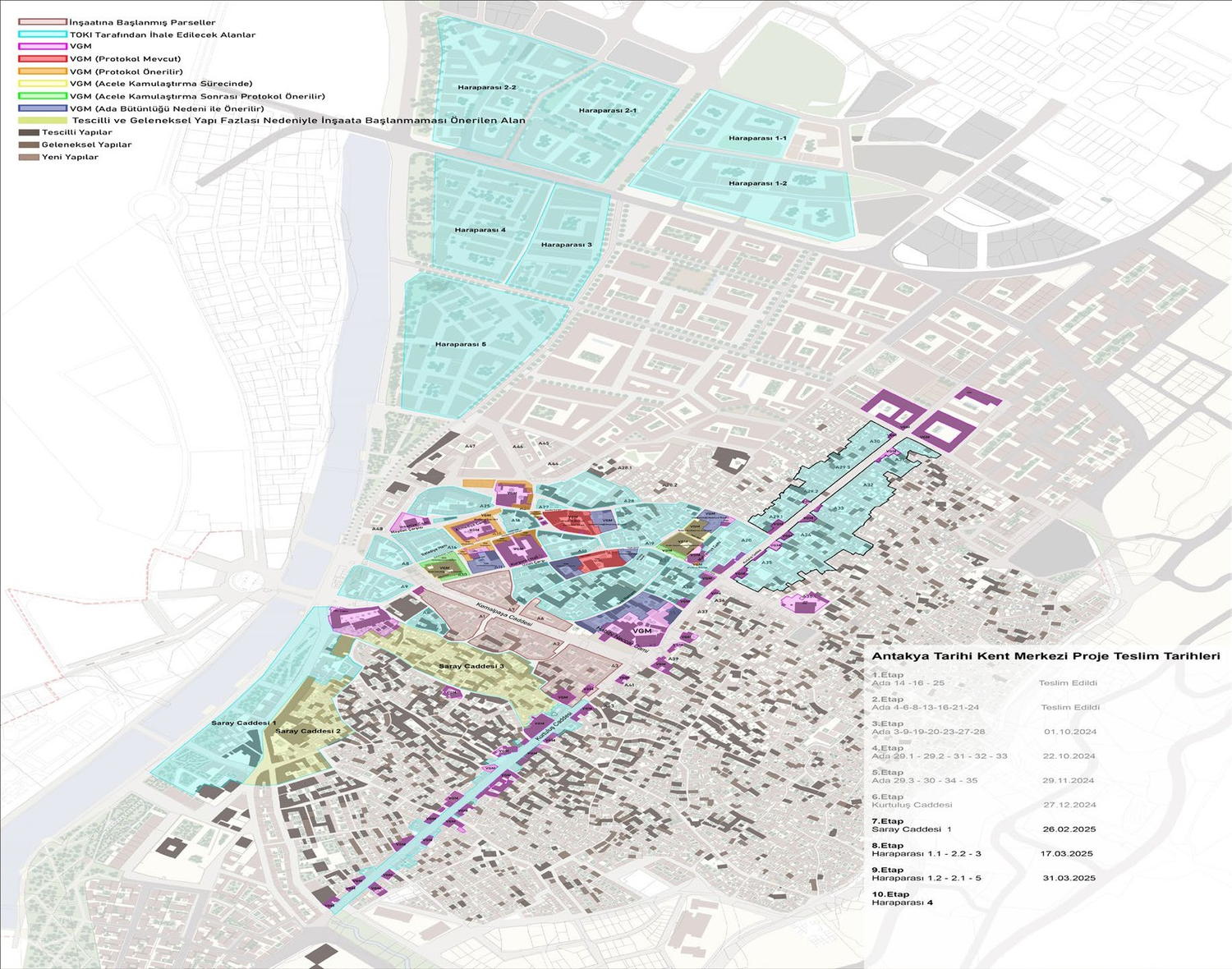
Parcel 1145 in District 5 lies within the area covered by the Conservation-Oriented Development Plan of the Antakya Historic City Centre. Because a large number of immovable cultural properties stand in its immediate surroundings, the building has been assessed within the integrity of the historic fabric. Conservation and design decisions were therefore developed with regard to the facade silhouette, the building height and the relationships with street and courtyard.
The Project in Numbers
District 5, Antakya
Scaled restitution drawings
From assessment to construction
Closest working scale
Project Process
Condition Assessment
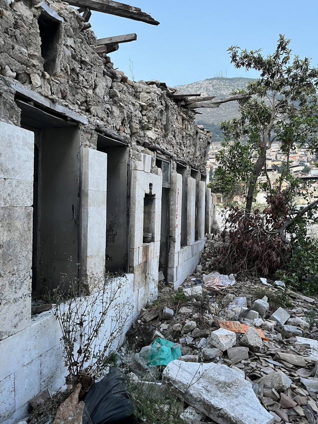
After the February 2023 earthquakes the building, which stands within the Antakya Urban Conservation Area, was severely damaged: part of it collapsed, while another part remained standing with its structural system impaired. The work therefore does not constitute a damage assessment in the conventional sense: it was conceived as a condition assessment focused on the measured documentation of the surviving architectural elements and on reading the traces that could be preserved at foundation and wall level in the collapsed parts. The spatial organisation, plan scheme and original architectural features of the building were reread and recorded by assessing together on-site measurement, the material remains identified in the debris field, oral history studies and written and visual archival documents. The aim was thus to document systematically the material and documentary traces of a damaged cultural property.
BasisVenice Charter art. 16 · Law No. 2863 · Regional Conservation Board notification
Project Sheets
Measured Survey Sheets
Measured documentation of the surviving parts of the severely damaged building
- Cadastral Situation
- Site Plan
- Ground Floor Plan
- Roof Plan
- Northeast Elevation
- Northwest Elevation
- Ground Floor Ceiling Plan
- Section AA
- Section BB
- Section CC
- Section DD
- Section EE
- Section FF
- Section GG
- Section HH
- Section II
- Details
Restitution — Plans
Evidence-based redrawing of the building’s original spatial organisation
- Cadastral Situation
- Cadastral Situation
- Ground Floor Plan
- First Floor Plan
- Ground Floor Structure Plan
- First Floor Structure Plan
- Ground Floor Ceiling Plan
- First Floor Ceiling Plan
- Roof Plan
Restitution — Elevations
The order of the street and courtyard elevations
- Cul-de-sac Elevation
- Courtyard Elevation
Restitution — Sections
Vertical spatial organisation and floor relationships
- Section AA
- Section BB
- Section CC
- Section DD
- Section EE
- Section FF
- Section GG
- Section HH
- Section II
- Section JJ
Reconstruction — Plans
The plan level of the document-based rebuilding decisions
- Cadastral Situation
- Cadastral Situation
- Ground Floor Plan
- First Floor Plan
- Ground Floor Structure Plan
- First Floor Structure Plan
- Ground Floor Ceiling Plan
- First Floor Ceiling Plan
- Roof Plan
Reconstruction — Elevations and Sections
Re-establishing the original building envelope and facade order
- Elevation
- Wall Type 6
- Section AA
- Section BB
- Section DD
- Section EE
- Section FF
- Section GG
- Section HH
- Section II
- Section JJ
Reconstruction — Construction Details
Traditional building techniques described at working scale
- Details
Project Team
- Yonca Yılmaz Çelebi
M.Arch · Conservation Specialist - Burcu Özlüoğlu
Architect - Eda Yabancı
Conservator
Method and Sources
The sequence followed in this file — documentation, diagnosis, evidence-based restitution, repair with minimum intervention — is the established method of the conservation literature. Intervention decisions were taken on the principles that repair must not begin before the cause of damage has been diagnosed, and that the degree of intervention rises from consolidation towards reconstruction only as far as necessity requires. For the theoretical framework see Zeynep Ahunbay, Tarihi Çevre Koruma ve Restorasyon (YEM Yayın, 2009); for the principles, the Venice Charter (1964), the Nara Document on Authenticity (1994) and Turkish Law No. 2863 on the Conservation of Cultural and Natural Property.
Services applied in this project
Related projects
View the project in presentation format
The submitted drawings, process account and typology cards for this parcel are available at full resolution in the horizontal presentation on the site.