 Restoration / Architecture · Design and Construction
Historic City Centre · ANTAKYA, HATAY
District 3, Parcel 84 — Reconstruction Project
The project covers the excavation survey, restitution and reconstruction of the building. Registered as a cultural property requiring conservation under inventory no. 38, the building collapsed entirely in the February 2023 earthquakes. The foundation and building traces uncovered by excavation were assessed together with the 1929 French cadastral sheet, a measured survey drawn in 1987, the photographic archive and an oral history study to form the restitution decisions, and the reconstruction projects were prepared in the light of the resulting data.
- Location
- District 3, Parcel 84
- Typology
- HOUSE
- Project type
- RECONSTRUCTION
- Status
- COMPLETELY COLLAPSED · EXCAVATION SURVEY COMPLETED
- Year
- 2025
- Scales
- 1/500 · 1/200 · 1/100 · 1/50 · 1/20
- Approving authority
- Hatay Regional Board for the Conservation of Cultural Property
About the Project
The project covers the excavation survey, restitution and reconstruction of the building. Registered as a cultural property requiring conservation under inventory no. 38, the building collapsed entirely in the February 2023 earthquakes. The foundation and building traces uncovered by excavation were assessed together with the 1929 French cadastral sheet, a measured survey drawn in 1987, the photographic archive and an oral history study to form the restitution decisions, and the reconstruction projects were prepared in the light of the resulting data.
Urban Context
Parcel 84 in District 3 lies within the area covered by the Conservation-Oriented Development Plan of the Antakya Historic City Centre. Standing on 1. Kilise Sokak in the Zenginler Quarter, the building adjoins the Orthodox church and its neighbouring parcels, and immovable cultural properties registered under inventory nos. 43, 39 and 17 stand nearby. The building has therefore been assessed within the integrity of the historic fabric, and conservation and design decisions were developed with regard to the facade silhouette, the building height and the relationships with street and courtyard.
The Project in Numbers
District 3, Zenginler Quarter
Excavation survey and reconstruction
From assessment to construction
Closest working scale
Project Process
Condition Assessment
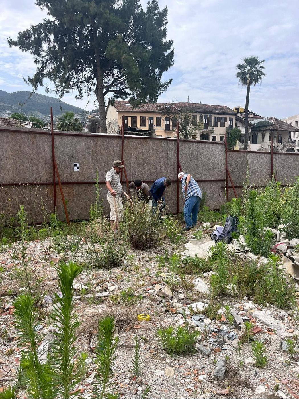
After the February 2023 earthquakes the building, which stood within the Antakya Urban Conservation Area, collapsed entirely, and its debris was sorted and removed from the site. The work therefore does not constitute a damage assessment in the conventional sense: it was conceived as a condition assessment focused on documenting the traces surviving at foundation level rather than any standing architectural elements. The spatial organisation, plan scheme and original architectural features of the building were reread and recorded by assessing together the foundation traces, the material remains identified in the debris field, oral history studies and written and visual archival documents. The aim was thus to document systematically the material and documentary traces of a cultural property that no longer exists.
BasisVenice Charter art. 16 · Law No. 2863 · Regional Conservation Board notification
Measured Survey — Excavation Survey
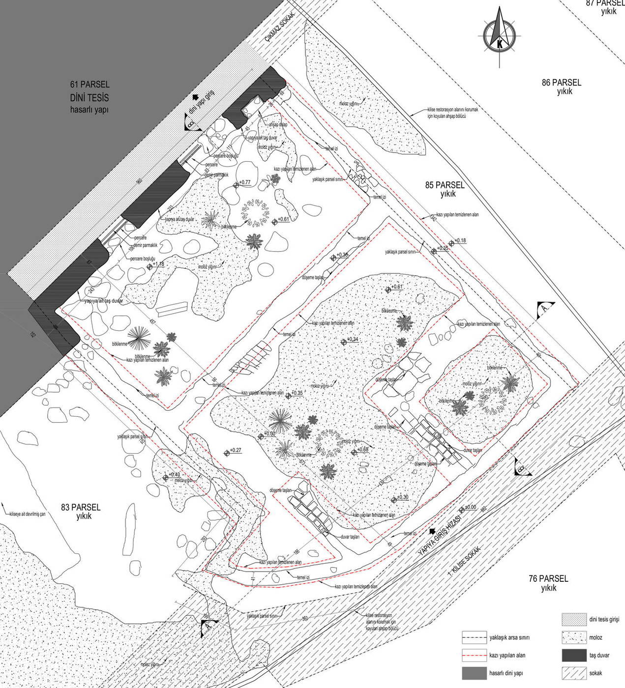
As the building had collapsed completely, an excavation survey was carried out instead of a measured survey. Rather than being cleared wholesale by machine, the debris was removed under control and in layers, with the discipline of an archaeological excavation; the architectural data revealed in each layer was measured and photographed before removal continued.
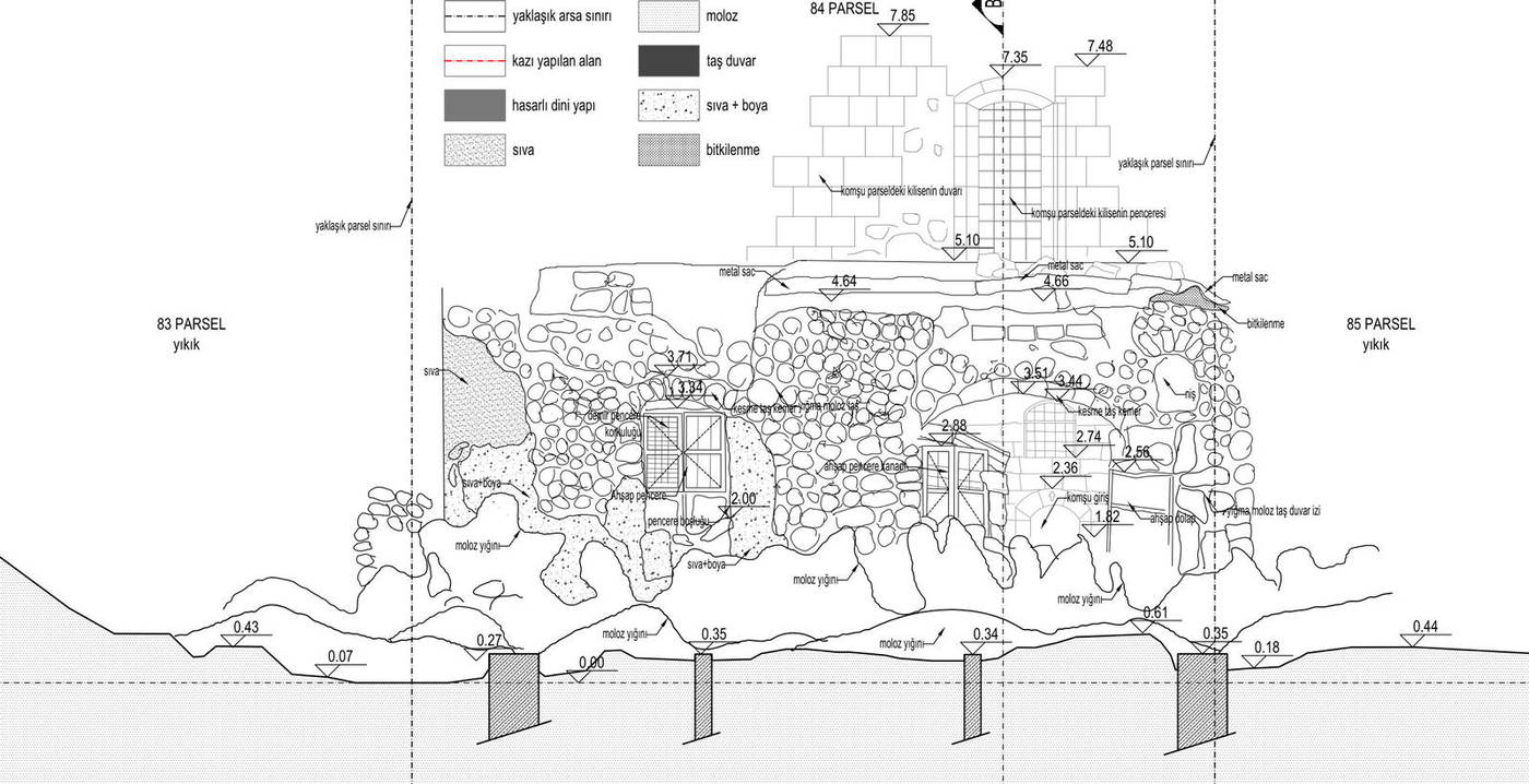
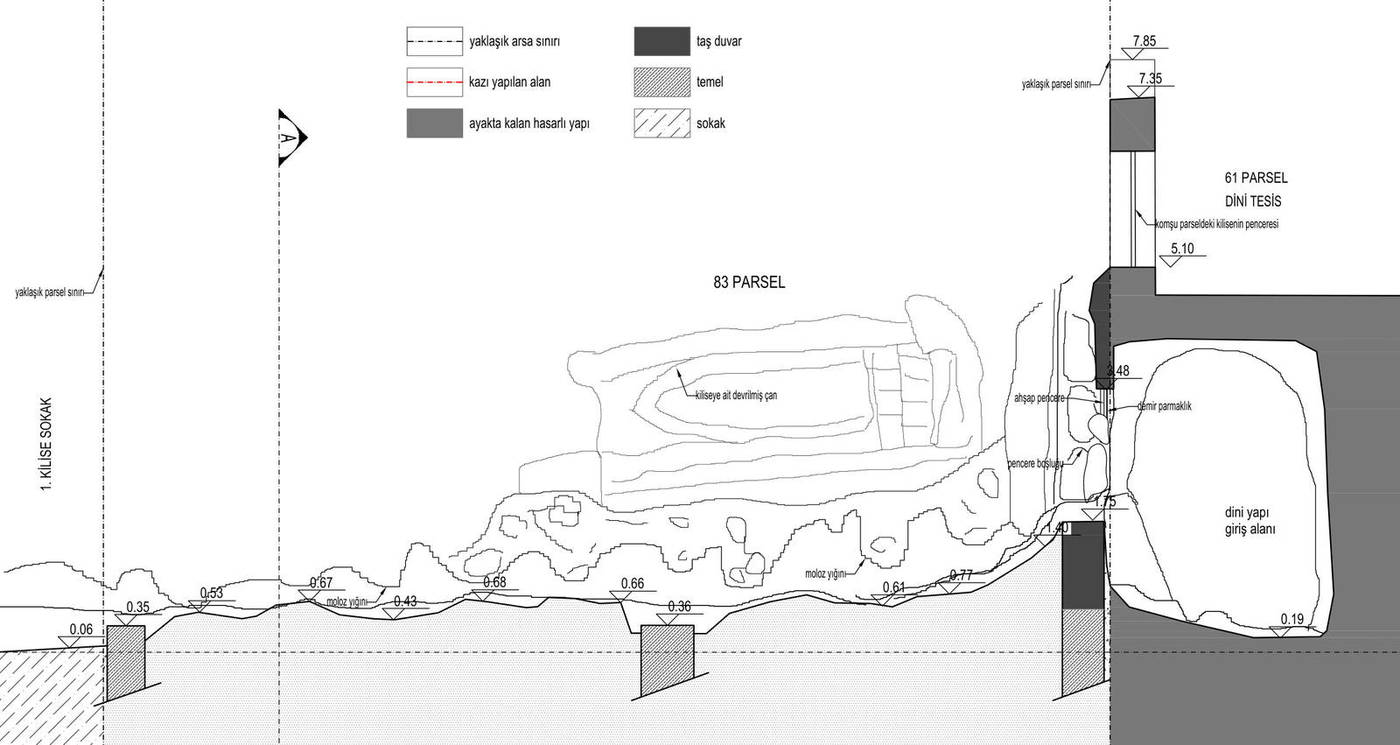
The foundation walls, wall bases, floor levels and traces of the courtyard’s stone paving that were uncovered have been measured and digitised. The sheets produced cover the cadastral situation, site plan, excavation plan and sections AA and BB. Traces of ashlar, rubble stone and timber tie-beams were listed separately in the material inventory, and original elements suitable for reuse were safely stacked on site.
Drawings from the excavation survey sheet that describe this stage
BasisVenice Charter art. 16 · Charter for the Protection of the Archaeological Heritage
Restitution
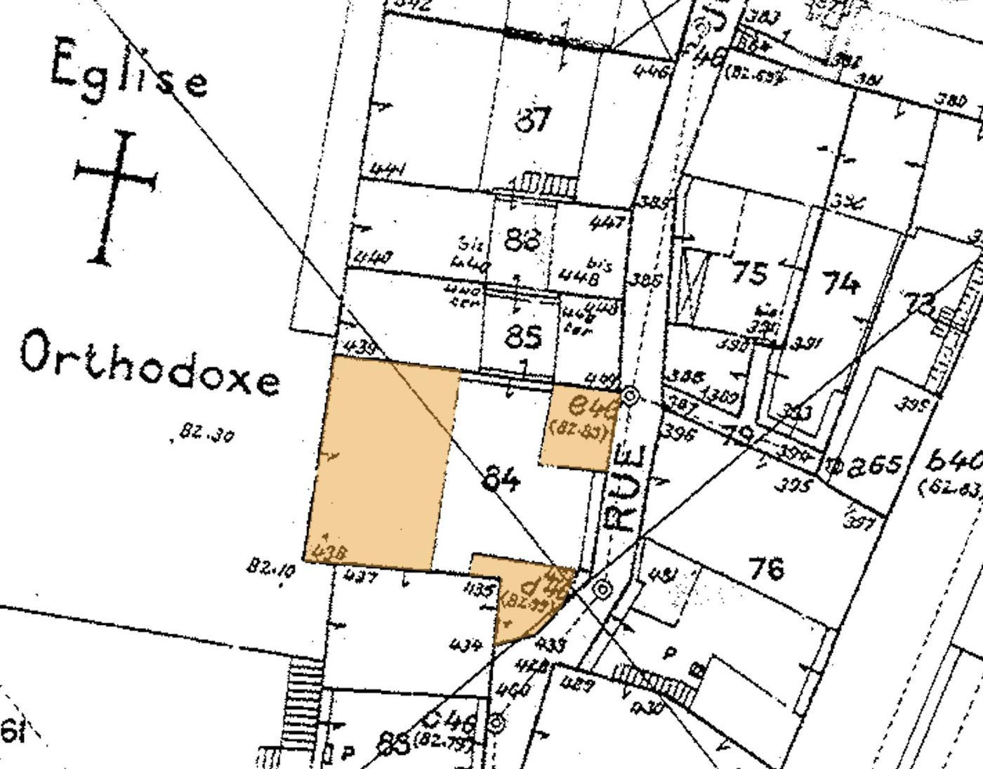
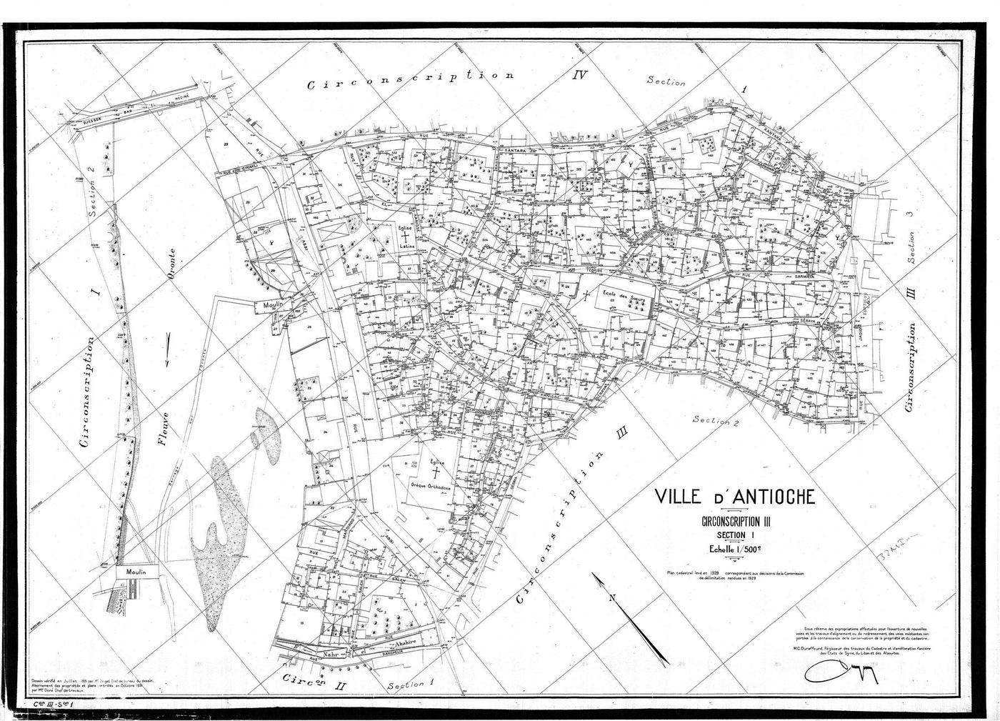
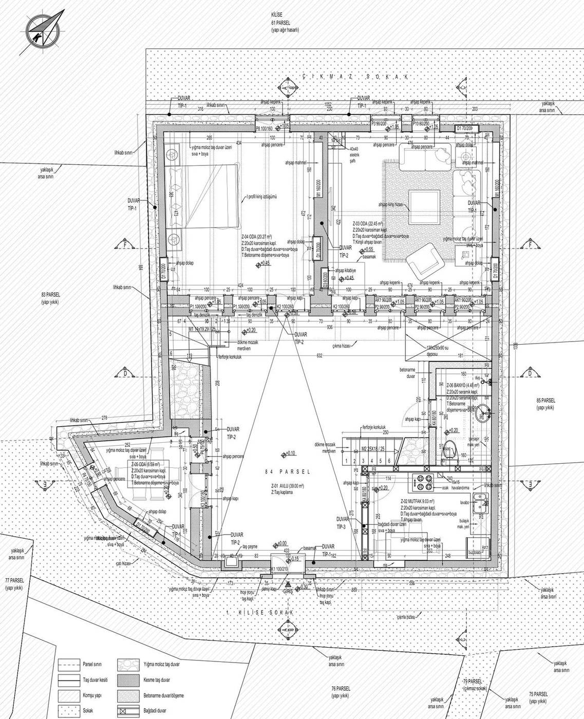
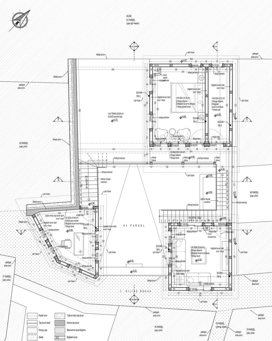
Restitution is the evidence-based reconstruction of the building’s original state before its collapse. On this parcel the concrete evidence comprises the 1929 French cadastral sheet, a measured survey of the building drawn in 1987, earlier restoration working drawings, the data obtained in the site excavation and the photographic archive.
Through an oral history study, the property’s most recent repairs, changes of use and alterations to the plan were documented from information given by former tenants and the owner. The building’s three main masses, which carry features of both the Ottoman period and the French Mandate, together with its arrangement around the courtyard and its floor organisation, were reread in the light of this data.
The plan drawings in which the restitution decisions are read
BasisVenice Charter art. 9–13 · Nara Document on Authenticity
Restoration Decisions
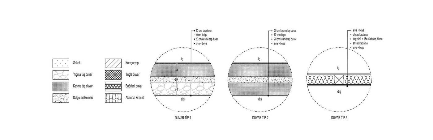
As the building was no longer standing, the conservation decisions turned towards defining the original qualities of the building to be rebuilt rather than intervening in existing fabric. Stone was specified for the main walls, the courtyard walls and the courtyard paving; timber for the upper-floor walls, the joinery, the bedding cupboards and other cupboards, the ceilings and the soffit lining.
Material and construction-system decisions
BasisVenice Charter art. 9–12 · Law No. 2863
Reconstruction
The reconstruction project defines the rebuilding of the original configuration established in the restitution, together with current building-safety requirements. As recorded in the drawing notes, the stone wall drawn at 25 cm in the earlier restoration file was widened to 40 cm following structural assessment, and the bağdadi lath-and-plaster walls were drawn at 16 cm on the basis of traditional Antakya details.
The stair dimensions were corrected by recalculating the building height and the riser height, which increased the number of steps. The external walls were brought into line with the building boundary, the stone walls on the upper floor were replaced with a bağdadi lath-and-plaster system, and all roofs were set with a 40 cm eaves projection and a 33 per cent pitch.
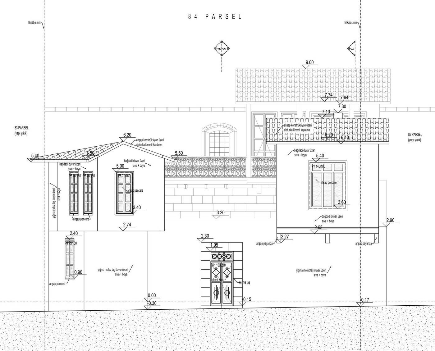
Elevations and sections from the reconstruction sheet
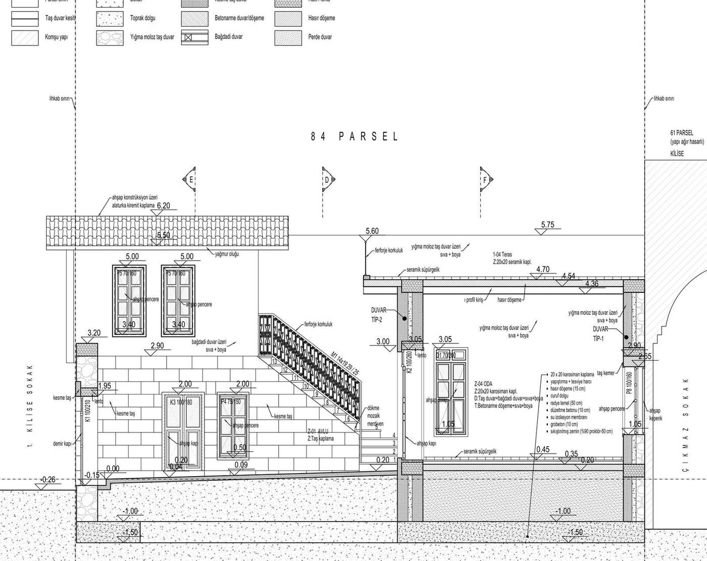
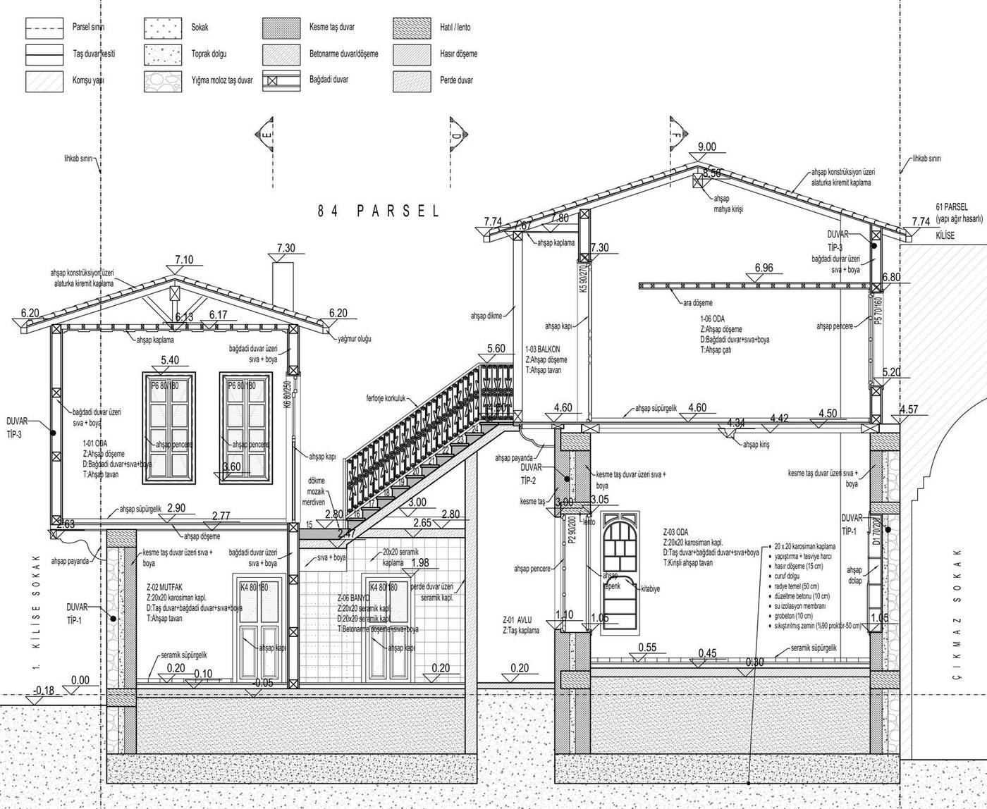
BasisVenice Charter art. 15 · Riga Charter · Regional Conservation Board approval
Construction and Supervision
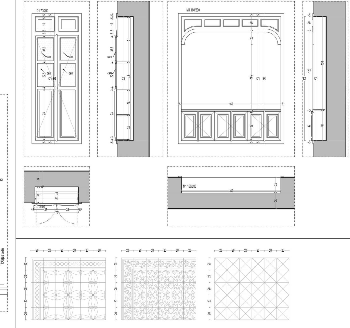
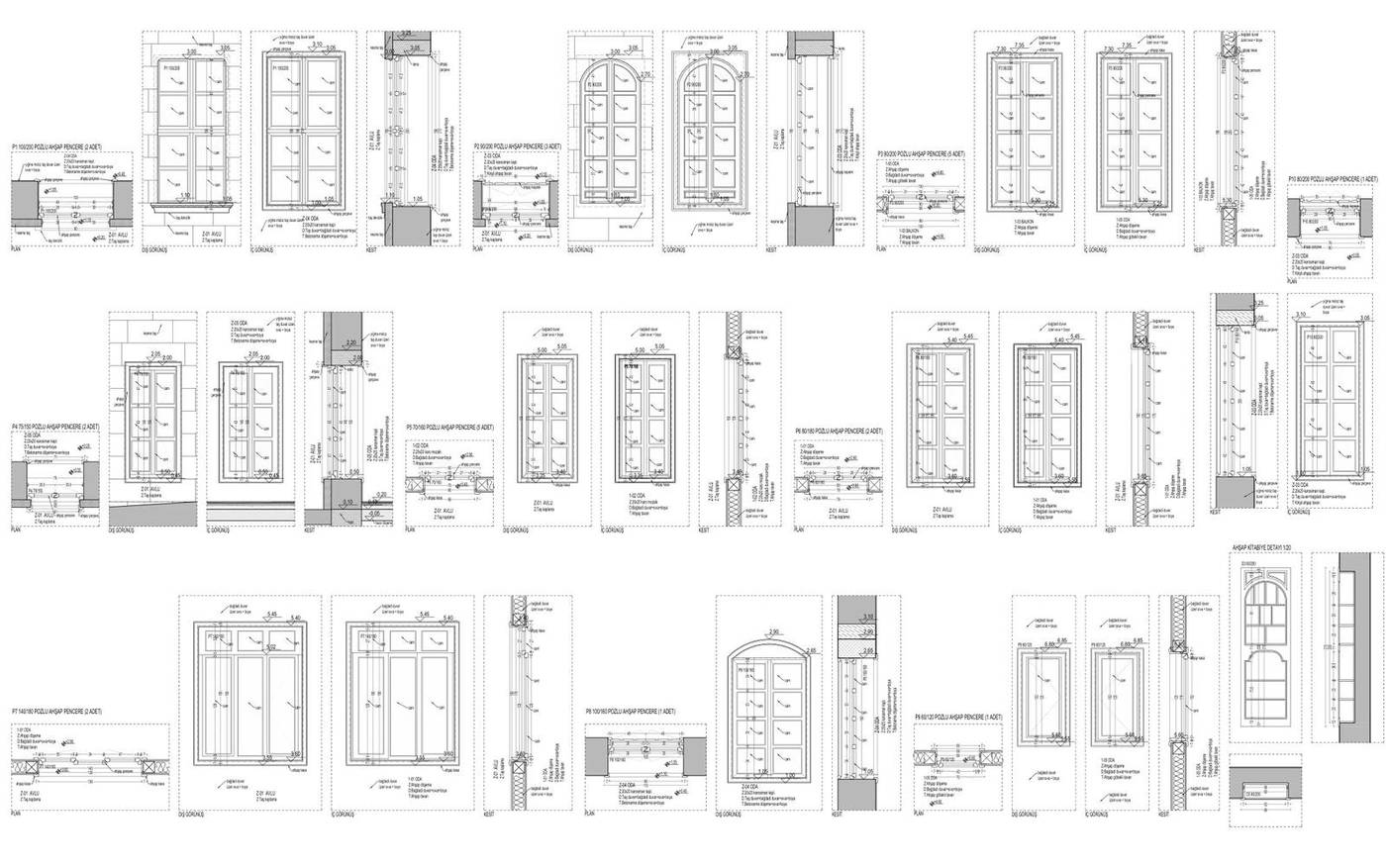
The construction stage is the process of producing the exact counterpart of the approved project on site. Door, window and stair details were drawn at working scale, and the frame, sill and stone-wall junction details of the timber joinery were defined individually.
Traditional construction details at working scale

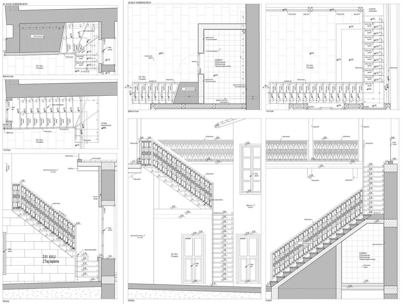
BasisVenice Charter art. 16 · Construction supervision and archiving
Typology of Building Elements
Hipped Roof Clad in Alaturka Tiles
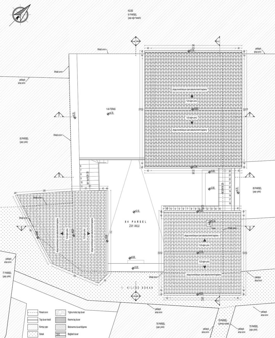
Because Antakya has heavy rainfall, roofs are steep and pitched; all are hipped roofs clad in alaturka tiles. In this building the roof pitch is set at 33 per cent and the eaves projection at 40 cm. The eaves overhang the street, giving shade and protecting the walls from rain.
Arched and Flat-Lintel Doors
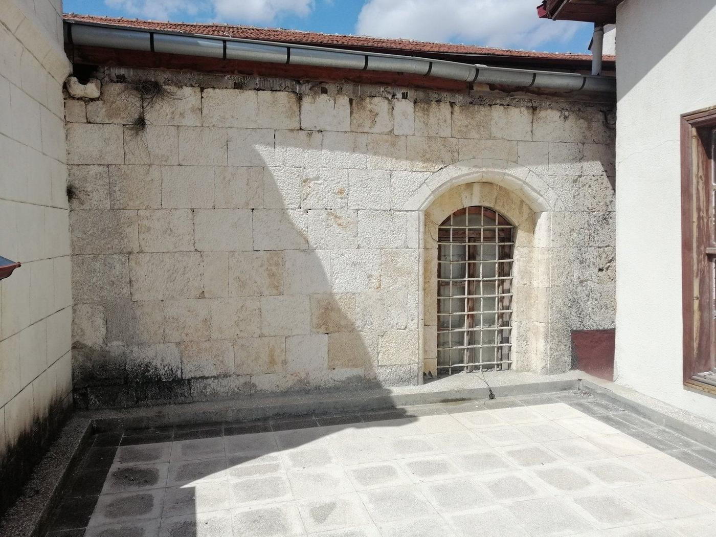
Two different architectural languages can be read between the two rooms north of the courtyard: the doors and windows of the western room are rectangular, while those of the northern room are segmentally arched. The element that links street and house is the double-leaf timber entrance door set within the thick courtyard wall.
Timber-Framed Windows
The windows are double-leaf timber units built with box-section profiles. Alongside straight-headed examples there are also openings spanned by a segmental arch. The stone sill and timber frame define the detail where the opening meets the stone wall.
The Courtyard’s External Stair
Access to the upper floor is by an external stair rising within the courtyard. There is a stair of 25 steps to the southeast of the courtyard and one of 15 steps to the northwest. The stair is not only a circulation element: the space beneath it becomes storage or a shaded area.
The Courtyard — Centre of the House
The L-shaped courtyard is entered through a double-leaf timber door on 1. Kilise Sokak. The ground floor rooms are set at the four corners of the courtyard, which works like a “sofa” hall linking every unit. Its walls are rubble stone and its floor is mosaic tile.
Mixed Construction System and Silhouette
The building carries features of both the Ottoman period and the French Mandate. Rubble-stone masonry walls 50–65 cm thick were used on the ground floor, and a bağdadi lath-and-plaster and timber-frame system above. The street elevation gains rhythm from the upper-floor windows and projecting eaves, taking its place in the silhouette.
Project Sheets
Excavation Survey Sheets
Scaled documentation of the traces revealed during debris removal
- EXCAVATION PLAN
- SECTION AA
- SECTION BB
- CADASTRAL SITUATION
- SITE PLAN
- DETAILS
Reconstruction — Plans
The plan level of the document-based rebuilding decisions
- GROUND FLOOR PLAN
- FIRST FLOOR PLAN
- CADASTRAL SITUATION
- SITE PLAN
- LICENSED SURVEY (LİHKAB) BOUNDARY
Reconstruction — Floors, Ceilings and Roof
The structure of the horizontal load-bearing planes and the roof
- GROUND FLOOR STRUCTURE PLAN
- FIRST FLOOR STRUCTURE PLAN
- GROUND FLOOR CEILING PLAN
- FIRST FLOOR CEILING PLAN
- ROOF PLAN
Reconstruction — Street Elevation and Wall Systems
Re-establishing the original envelope, facade order and construction technique
- 1. KİLİSE SOKAK ELEVATION
- WALL TYPES
- TIMBER AND CERAMIC DETAILS
Reconstruction — Sections
Vertical spatial organisation and floor relationships
- SECTION AA
- SECTION BB
- SECTION CC
- SECTION DD
- SECTION EE
- SECTION FF
Reconstruction — Architectural Details
The door, window and stair elements described at working scale
- DOOR DETAILS
- WINDOW DETAILS
- STAIR DETAILS
Project Team
- Yonca Yılmaz Çelebi
M.Arch · Conservation Specialist - Burcu Özlüoğlu
Architect - Eda Yabancı
Conservator
Method and Sources
The sequence followed in this file — documentation, diagnosis, evidence-based restitution, repair with minimum intervention — is the established method of the conservation literature. Intervention decisions were taken on the principles that repair must not begin before the cause of damage has been diagnosed, and that the degree of intervention rises from consolidation towards reconstruction only as far as necessity requires. For the theoretical framework see Zeynep Ahunbay, Tarihi Çevre Koruma ve Restorasyon (YEM Yayın, 2009); for the principles, the Venice Charter (1964), the Nara Document on Authenticity (1994) and Turkish Law No. 2863 on the Conservation of Cultural and Natural Property.
Services applied in this project
Related projects
View the project in presentation format
The submitted drawings, process account and typology cards for this parcel are available at full resolution in the horizontal presentation on the site.