 Restoration / Architecture · Design and Construction
Historic City Centre · ANTAKYA, HATAY
District 3, Parcel 1236 — Measured Survey + Restitution + Reconstruction Project
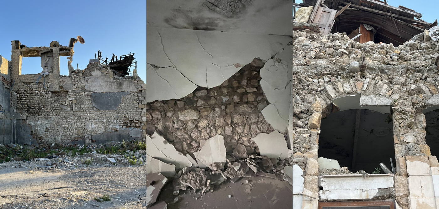
The project covers the measured survey, restitution and reconstruction of the severely damaged building on parcel 1236 in District 3. The surviving fragments of stone and brick wall, the remains of floors and roof, the original openings and the traces relating to the courtyard were documented through measured drawings and site photographs.
- Location
- District 3, Parcel 1236
- Typology
- HOUSE + COMMERCIAL
- Project type
- MEASURED SURVEY + RESTITUTION + RECONSTRUCTION
- Status
- SEVERELY DAMAGED · MEASURED SURVEY, RESTITUTION AND RECONSTRUCTION COMPLETED
- Year
- 2026
About the Project
The project covers the measured survey, restitution and reconstruction of the severely damaged building on parcel 1236 in District 3. The surviving fragments of stone and brick wall, the remains of floors and roof, the original openings and the traces relating to the courtyard were documented through measured drawings and site photographs.
At the restitution stage, the plan scheme, the arrangement of rooms around the courtyard, the timber floors and ceilings, the arched openings, the ashlar surrounds and the facade character were assessed through the traces of each period. The reconstruction project turns this data into a legible, integrated building composition compatible with traditional materials and building systems.
Urban Context
Parcel 1236 in District 3 holds a two-storey mixed-use building on Şinasi Sokak in the Antakya Historic City Centre, developed around a courtyard. The parcel’s boundary relationships with parcels 169, 1231, 1232, 1235 and its other neighbours were assessed together with the street elevation, the courtyard entrance, the garden walls and the post-earthquake condition of the surrounding buildings. The building’s place in the street silhouette and the inward-looking composition formed by its courtyard and service spaces are the basis of the project decisions.
The Project in Numbers
District 3, Şinasi Street
Ground and first floor
Measured survey, restitution and reconstruction
Documentation of damage and materials
Project Process
Measured Survey — Post-Earthquake Documentation
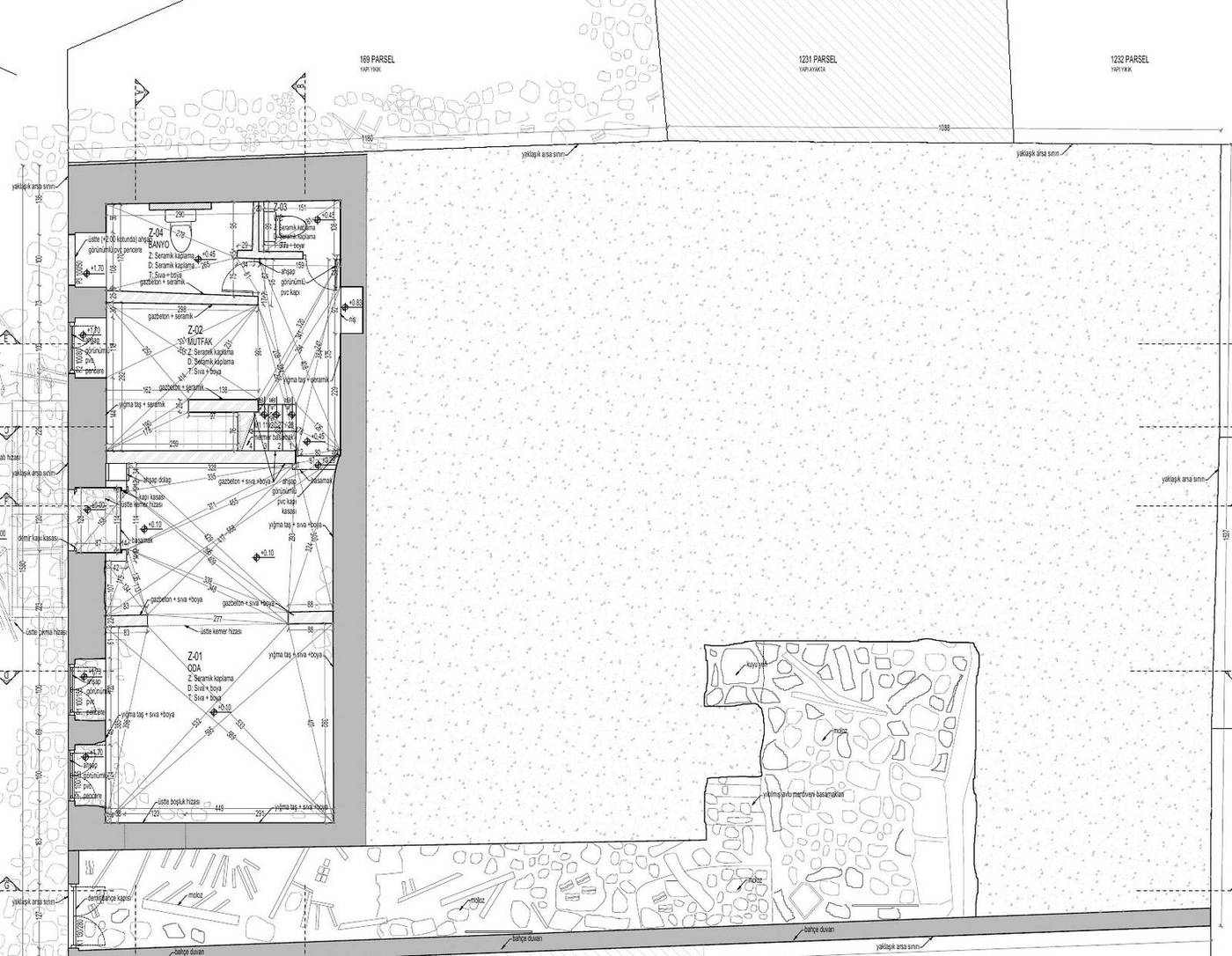
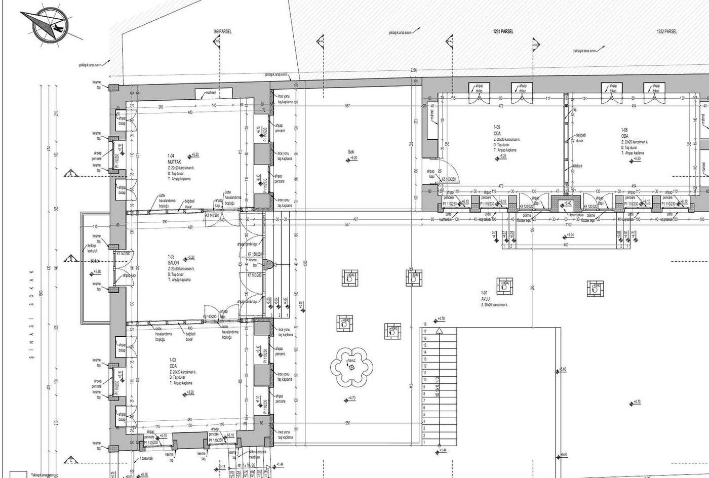
The measured survey documents both the surviving and the collapsed parts of the severely damaged building, together with the parcel boundaries. The ground and first floor rooms, the courtyard, garden walls, traces of neighbouring buildings and the different levels are read within a common measurement system.
The elevation and roof drawings distinguish the stone masonry walls, plaster losses, timber roof members, joinery and areas of rubble, recording the effect of the damage on the integrity of the building.
Key plan drawings from the measured survey sheet
BasisOn-site measurement · photographic damage documentation · readings of the parcel and its neighbours
Restitution — Reading the Building Traces
The restitution assesses the survey data together with the surviving building traces and the architectural character of the period. The relationship between the rooms, hall, kitchen and service units around the courtyard is reread together with the timber circulation elements and the organisation of the upper floor.
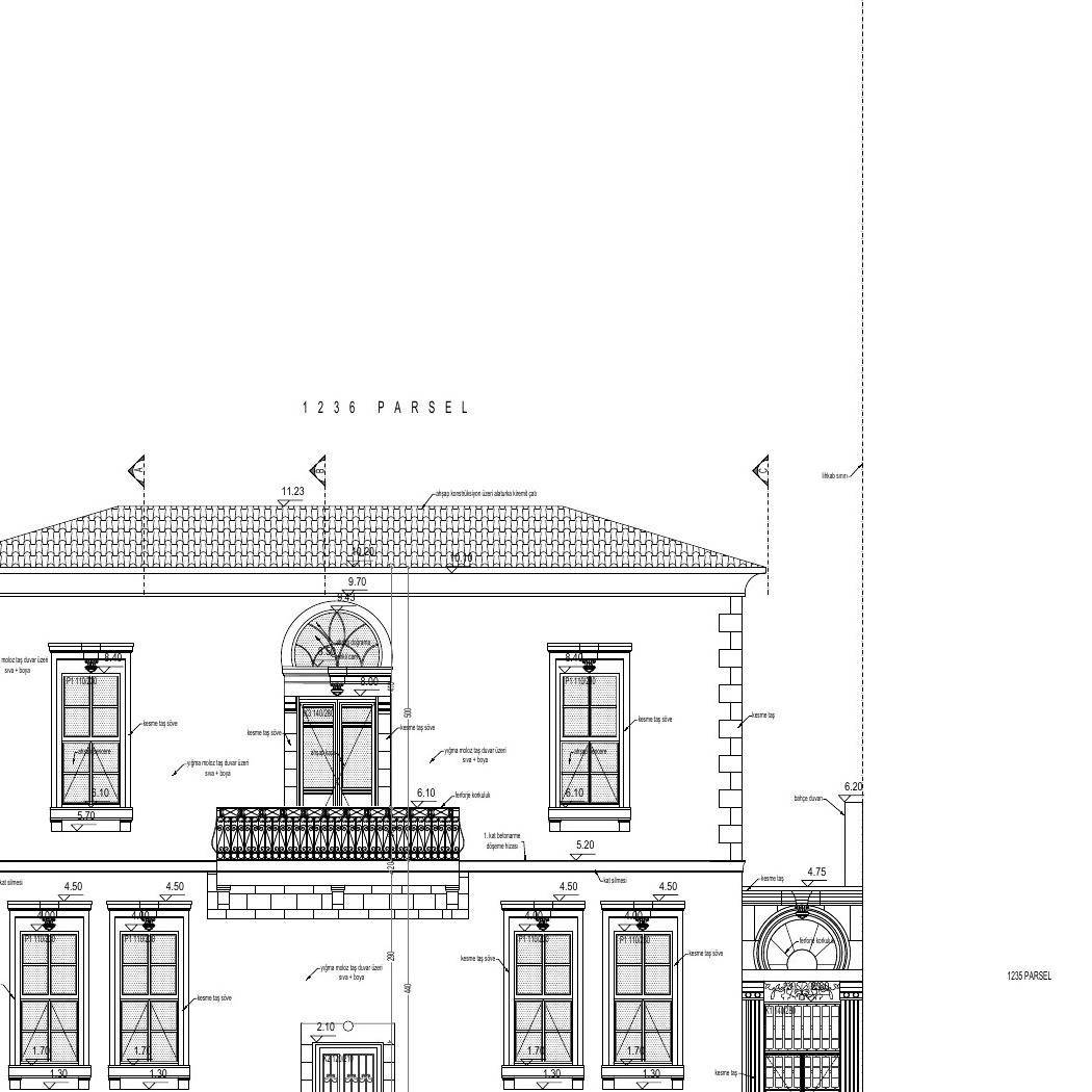
The northwest street elevation, the arched openings, ashlar surrounds, timber joinery, balcony and hipped roof have been treated as the basic elements that define the building’s original facade order and its place in the street silhouette.
Plans and spatial organisation from the restitution sheet
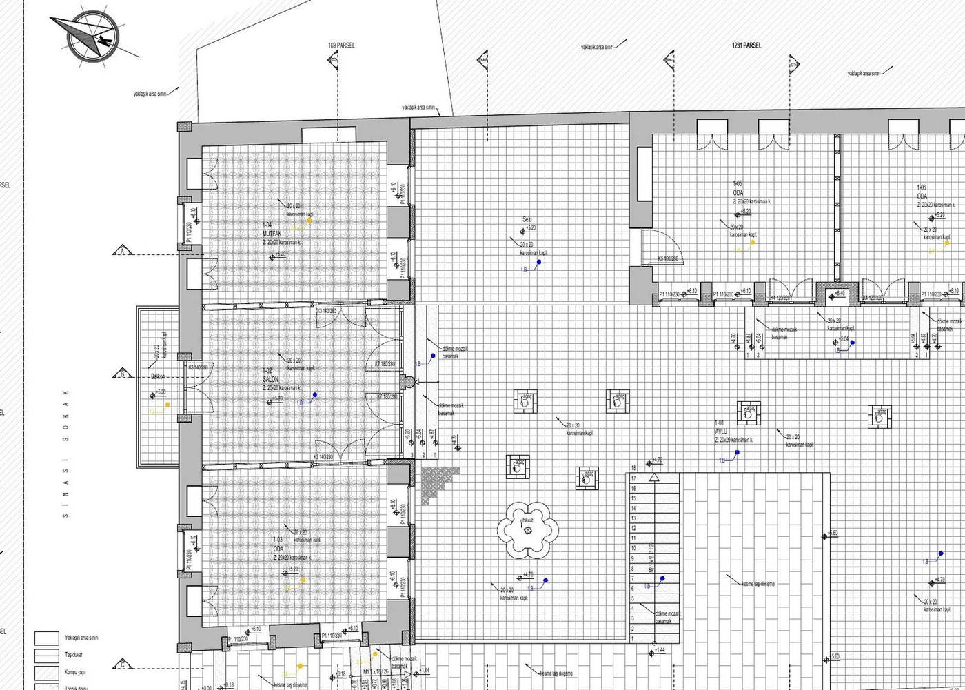
BasisSurvey data · building traces · period analysis of plans and elevations
Reconstruction — Establishing Architectural Integrity
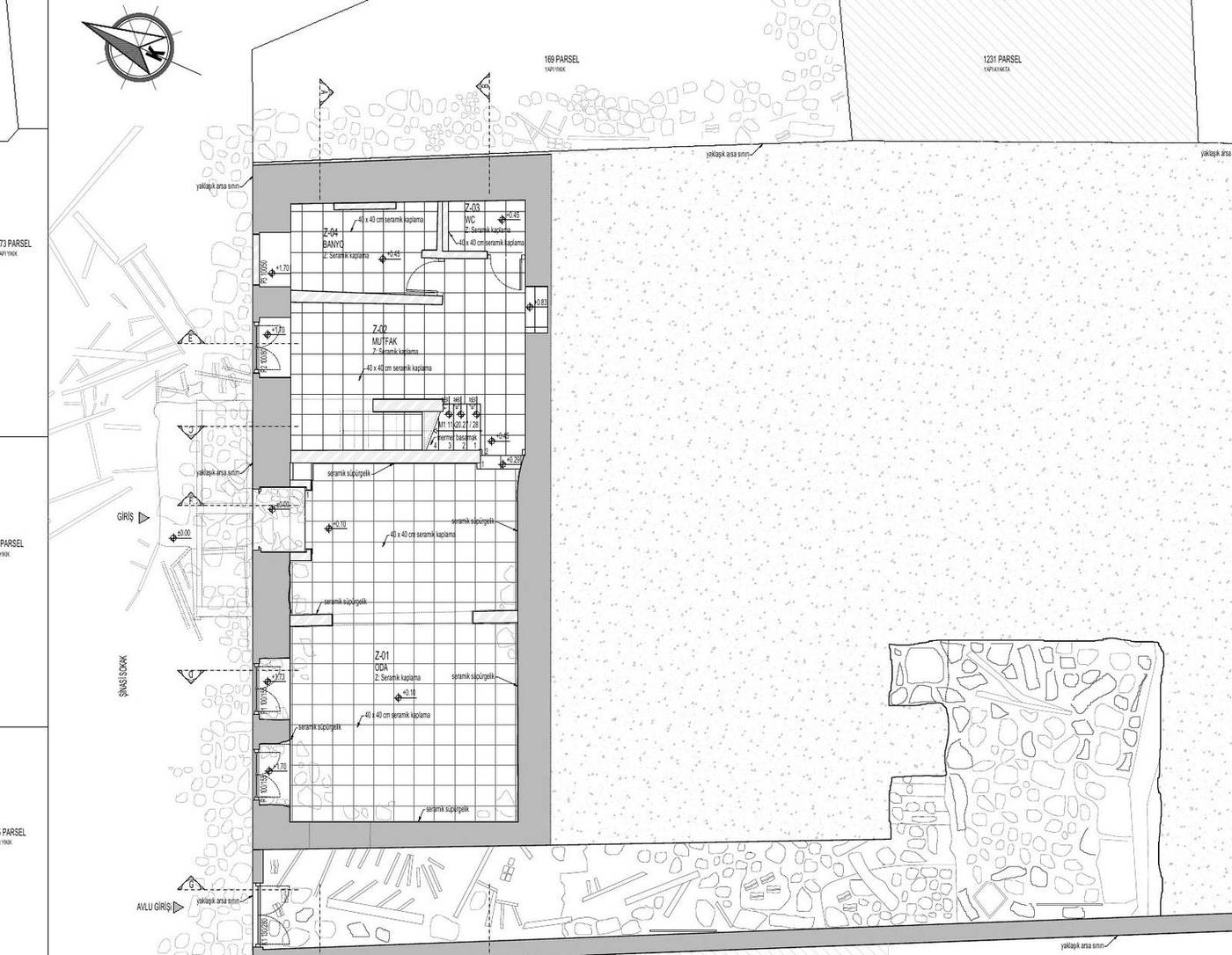
The reconstruction project rebuilds the courtyard plan scheme and facade character established in the restitution, in keeping with traditional building systems. The living and service units on the ground floor and the rooms above form an integrated composition around the courtyard and the external circulation.
Stone masonry walls, timber floors and ceilings, a hipped roof clad in alaturka tiles, ashlar surrounds, timber joinery and wrought-iron balustrades are the basic architectural components of the project.
Selected plans and elevations from the reconstruction project
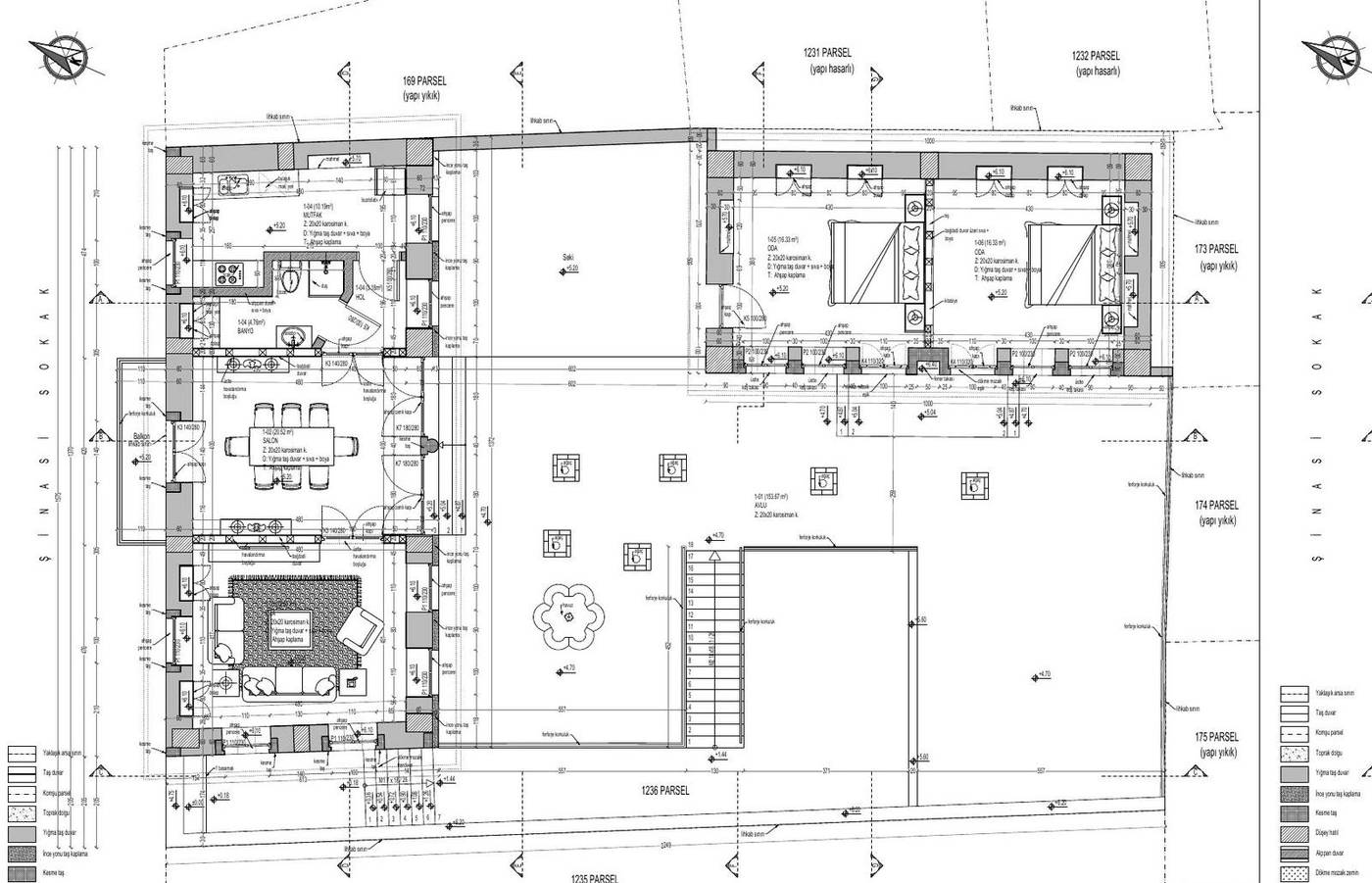
BasisRestitution decisions · the original plan scheme · traditional material and building technique
Project Sheets
Measured Survey and Restitution — Building Traces
Selected plan, roof and elevation drawings reaching from the existing condition to the restitution decisions
- MEASURED SURVEY — GROUND FLOOR
- ROOF AND DAMAGE TRACES
- NORTHWEST ELEVATION
- RESTITUTION — SECTION AA
Reconstruction — Plans, Ceilings and Elevations
Selected drawings of the spatial organisation to be rebuilt and of the street elevation
- GROUND FLOOR PLAN
- CEILING PLAN
- NORTHWEST ELEVATION
Project Team
- Yonca Yılmaz Çelebi
M.Arch · Conservation Specialist - Burcu Özlüoğlu
Architect - Eda Yabancı
Conservator
Method and Sources
The sequence followed in this file — documentation, diagnosis, evidence-based restitution, repair with minimum intervention — is the established method of the conservation literature. Intervention decisions were taken on the principles that repair must not begin before the cause of damage has been diagnosed, and that the degree of intervention rises from consolidation towards reconstruction only as far as necessity requires. For the theoretical framework see Zeynep Ahunbay, Tarihi Çevre Koruma ve Restorasyon (YEM Yayın, 2009); for the principles, the Venice Charter (1964), the Nara Document on Authenticity (1994) and Turkish Law No. 2863 on the Conservation of Cultural and Natural Property.
Services applied in this project
Related projects
View the project in presentation format
The submitted drawings, process account and typology cards for this parcel are available at full resolution in the horizontal presentation on the site.