 Restoration / Architecture · Design and Construction
Historic City Centre · ANTAKYA, HATAY
District 3, Parcel 310 — Reconstruction Project
The project covers the debris survey, restitution and reconstruction of the house on parcel 310 in District 3. The foundation and parcel traces of the building, which collapsed completely after the February 2023 earthquakes, were documented through an excavation survey, and the cadastral records, pre-earthquake photographs and architectural details of the building were assessed together.
- Location
- District 3, Parcel 310
- Typology
- HOUSE
- Project type
- RECONSTRUCTION
- Status
- COMPLETELY COLLAPSED · EXCAVATION SURVEY COMPLETED
- Year
- 2026
About the Project
The project covers the debris survey, restitution and reconstruction of the house on parcel 310 in District 3. The foundation and parcel traces of the building, which collapsed completely after the February 2023 earthquakes, were documented through an excavation survey, and the cadastral records, pre-earthquake photographs and architectural details of the building were assessed together.
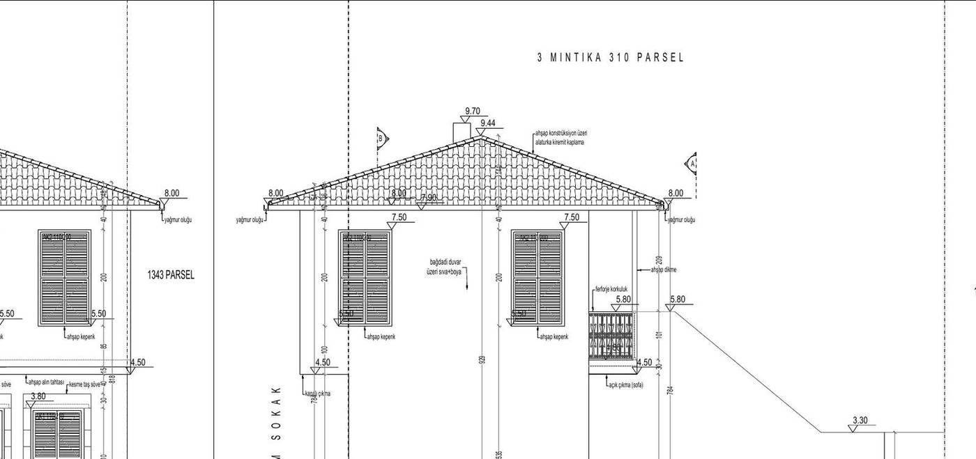
The restitution reread the ground and first floor plans, the floor and ceiling structure, the roof, the street and courtyard elevations and the door, window and stair elements. On this scientific base, a reconstruction project was prepared that sustains the original massing, facade rhythm, timber joinery and external stair of the two-storey house.
Urban Context
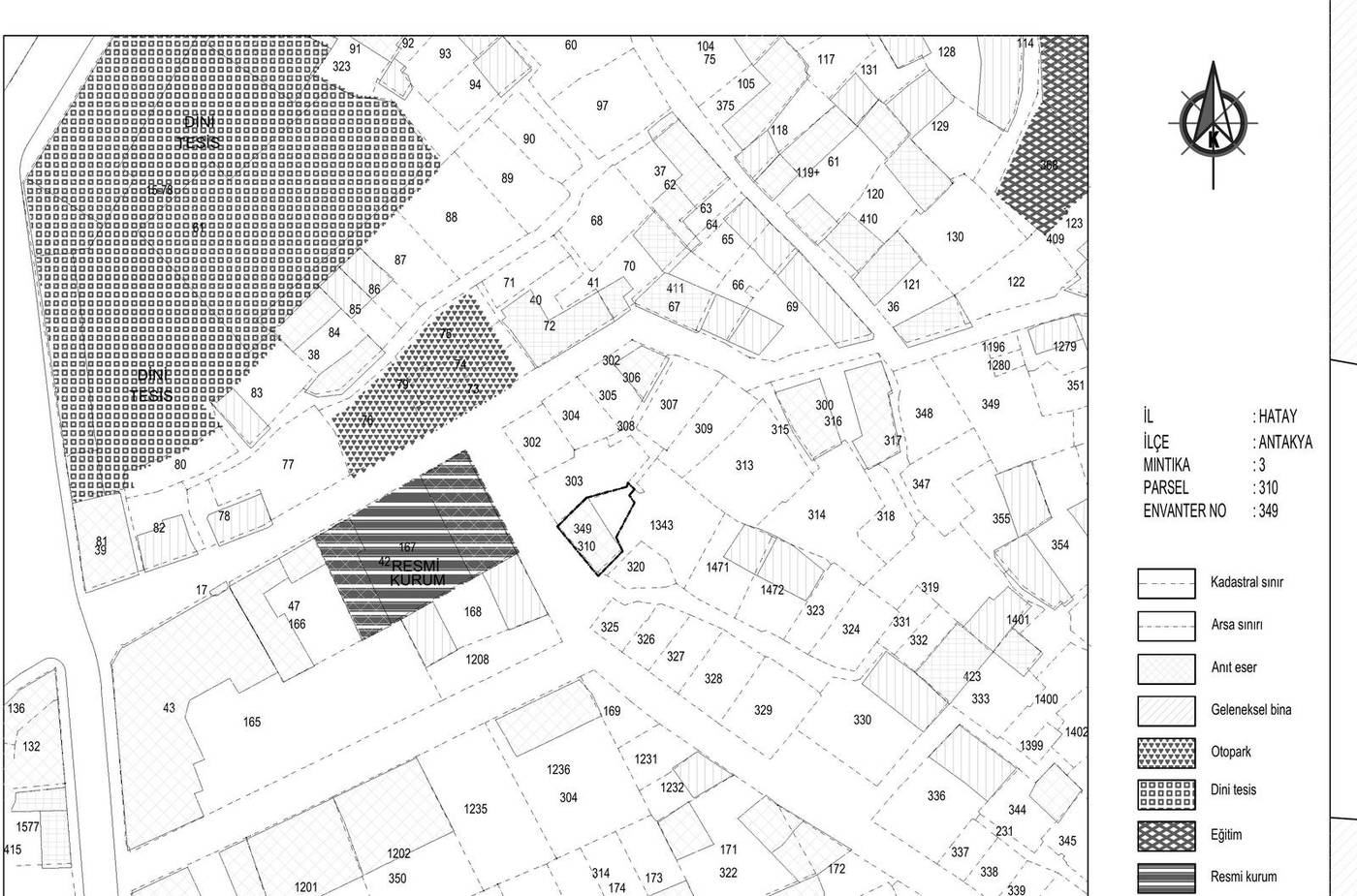
Parcel 310 in District 3 lies within the area covered by the Conservation-Oriented Development Plan of the Antakya Historic City Centre. The narrow, deep parcel layout of this immovable cultural property, inventory no. 349, its position adjoining the neighbouring buildings and its facade relationship with the street were assessed together. Readings of the cadastral situation and the site plan formed the basis, in the reconstruction decisions, for preserving the parcel boundary, the original building envelope and the courtyard-to-building relationship.
The Project in Numbers
District 3, Antakya
Immovable cultural property
Measured survey, restitution, reconstruction
The layout of the house around the courtyard
Project Process
Debris Survey
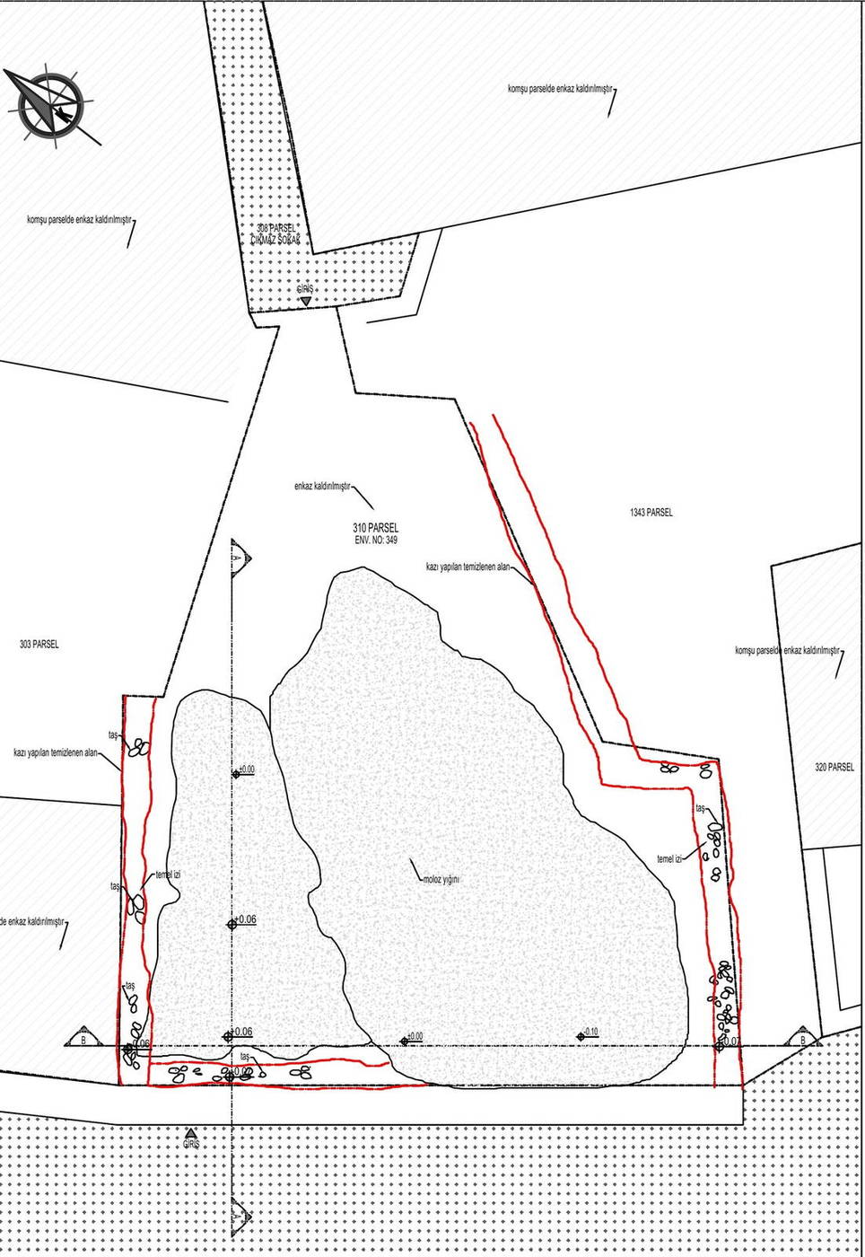
As the building had collapsed completely, the work focused on recording the traces surviving at foundation level rather than on a conventional measured survey of a standing building. On the excavation plan, the parcel boundary, the excavated area, the rubble heap and the uncovered building traces are documented in separate notations.
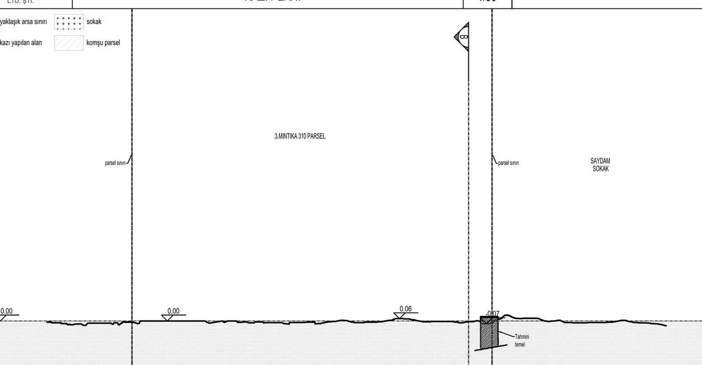
Sections AA and BB, prepared together with the cadastral situation, site plan and licensed survey boundary, record the parcel’s relationship with the neighbouring buildings and the street level, and provide a measurable base for the restitution.
Excavation plan and site sections from the debris survey
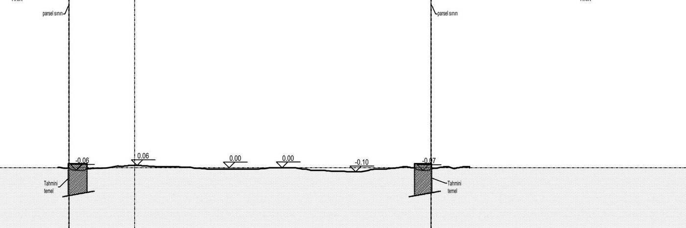
BasisLaw No. 2863 · Venice Charter art. 16 · measured and photographic documentation
Restitution
Restitution rebuilds, on the basis of documents, the spatial and architectural character the building had before the earthquake. The ground and first floor plans were developed by reading together the parcel geometry, the photographic archive, the original building elements and a comparative typology of the Antakya house.
The shuttered timber openings on the street and courtyard elevations, the hipped roof, the external stair and the proportions of the doors and windows are defined in separate drawings; each decision is linked to reliability and period data.
Plans and roof structure from the restitution sheet
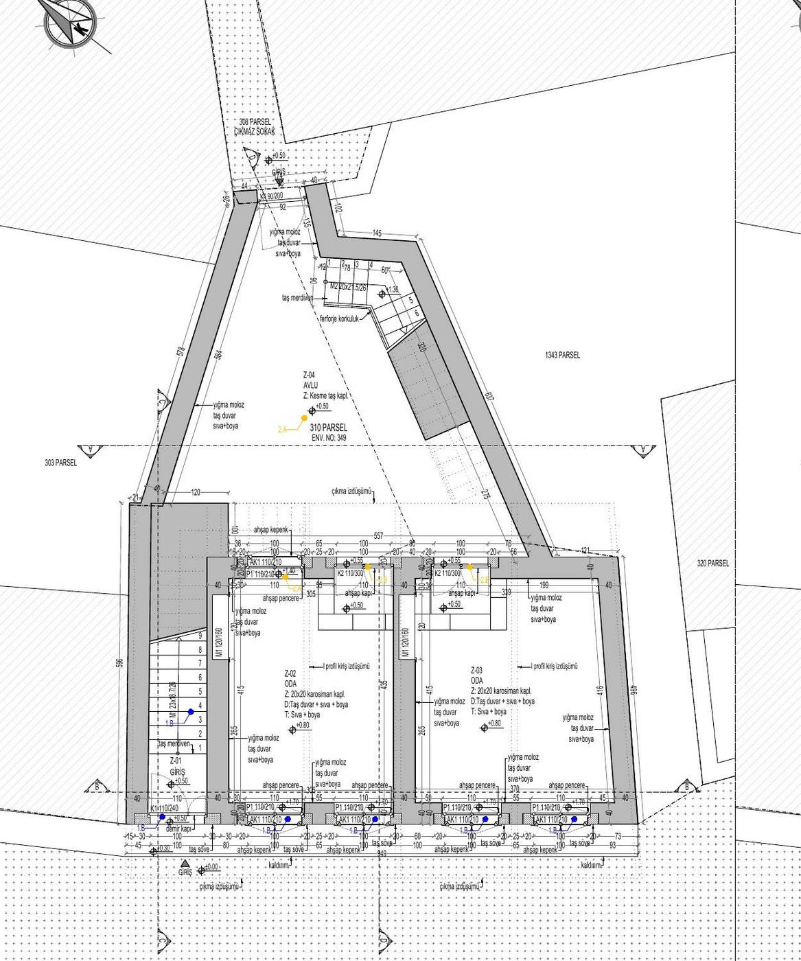
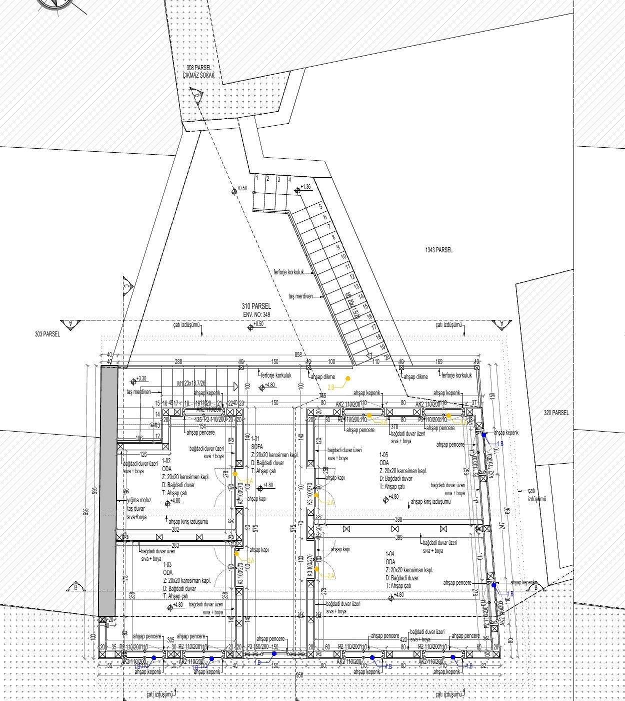
BasisVenice Charter art. 9–13 · Nara Document on Authenticity · archives and building traces
Reconstruction
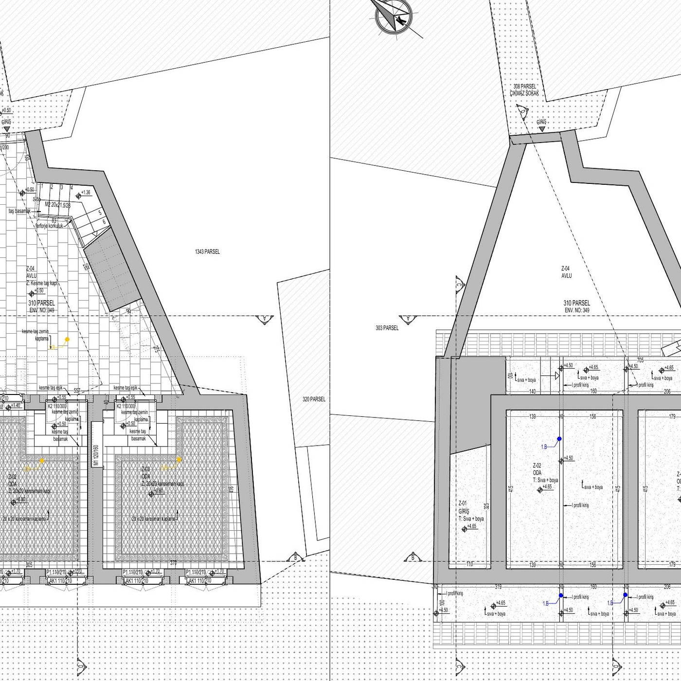
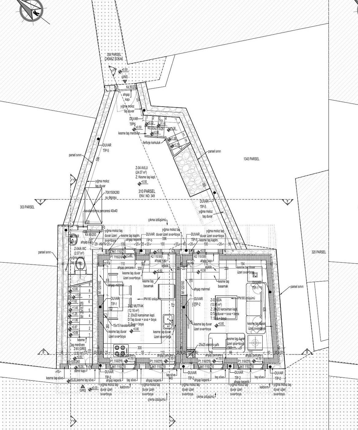
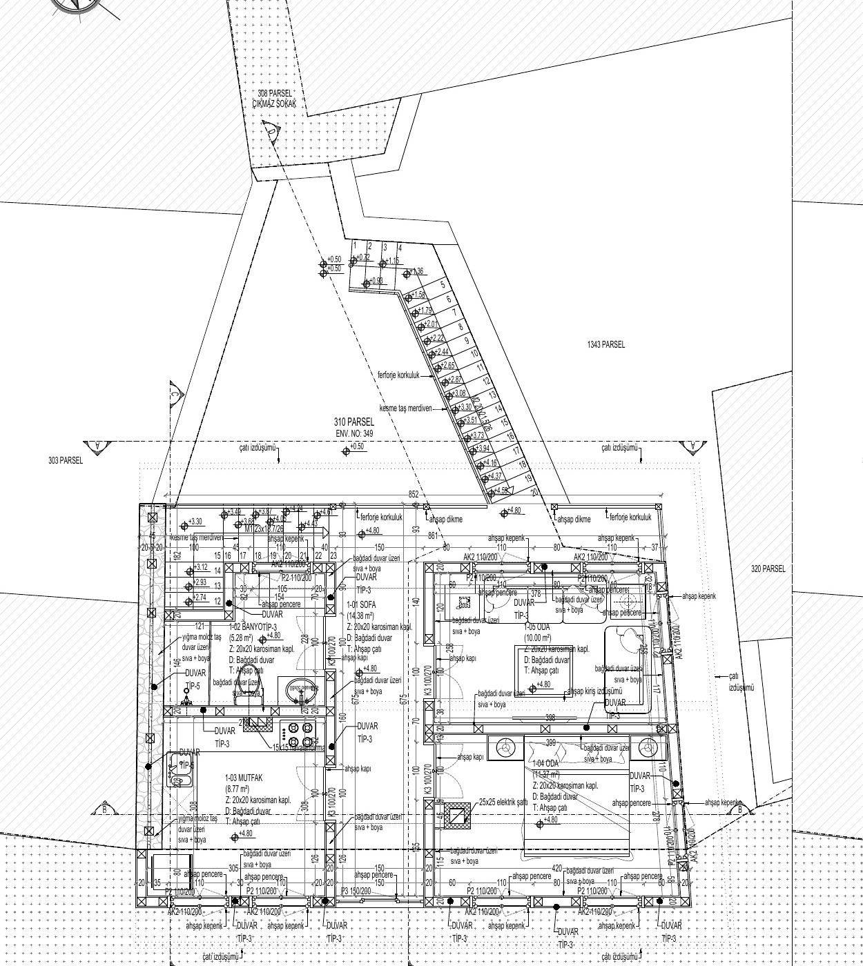
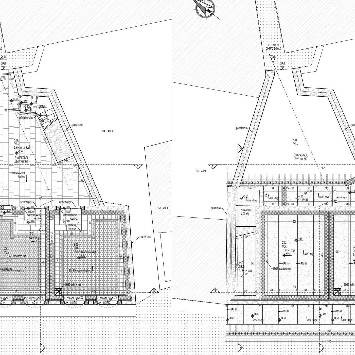
The reconstruction project brings together the original configuration evidenced in the restitution and current structural safety requirements. The plan, floor, ceiling and roof sheets define, at working scale, the distribution of spaces around the courtyard of this two-storey house and their vertical relationships.
In the elevation, section and detail sheets, the hipped roof, shuttered timber joinery, stone wall openings and external stair are resolved within a single construction language; the rebuilding decisions have been brought into line with the parcel boundary and the original building envelope.
Plans and roof structure from the reconstruction sheet
BasisVenice Charter art. 15 · Riga Charter · Regional Conservation Board approval
Project Sheets
Restitution — Elevations, Sections and Details
Evidence-based rereading of the architectural character before the earthquake
- STREET AND COURTYARD ELEVATIONS
- BUILDING SECTIONS
- DOOR AND WINDOW DETAILS
Reconstruction — Elevations, Sections and Details
The original envelope and building elements described at working scale
- STREET AND COURTYARD ELEVATIONS
- BUILDING SECTIONS
- DOOR AND WINDOW DETAILS
Project Team
- Yonca Yılmaz Çelebi
M.Arch · Conservation Specialist - Burcu Özlüoğlu
Architect - Eda Yabancı
Conservator
Method and Sources
The sequence followed in this file — documentation, diagnosis, evidence-based restitution, repair with minimum intervention — is the established method of the conservation literature. Intervention decisions were taken on the principles that repair must not begin before the cause of damage has been diagnosed, and that the degree of intervention rises from consolidation towards reconstruction only as far as necessity requires. For the theoretical framework see Zeynep Ahunbay, Tarihi Çevre Koruma ve Restorasyon (YEM Yayın, 2009); for the principles, the Venice Charter (1964), the Nara Document on Authenticity (1994) and Turkish Law No. 2863 on the Conservation of Cultural and Natural Property.
Services applied in this project
Related projects
View the project in presentation format
The submitted drawings, process account and typology cards for this parcel are available at full resolution in the horizontal presentation on the site.