 Restoration / Architecture · Design and Construction
Historic City Centre · ANTAKYA, HATAY
District 3, Parcel 634 — Reconstruction Project
The project covers the excavation survey, restitution and reconstruction of the building. The foundation and wall traces of the structure, which collapsed entirely in the February 2023 earthquakes, were documented through an excavation survey; the 1929 Ville d’Antioche cadastral sheet, the pre-earthquake photographic archive, historic aerial photographs and an oral history study were assessed together to form the restitution decisions, and the reconstruction projects were prepared in the light of the resulting data.
- Location
- District 3, Parcel 634
- Typology
- HOUSE
- Project type
- RECONSTRUCTION
- Status
- COMPLETELY COLLAPSED · EXCAVATION SURVEY COMPLETED
- Year
- 2026
- Scales
- 1/500 · 1/200 · 1/100 · 1/50 · 1/20
- Approving authority
- Hatay Regional Board for the Conservation of Cultural Property
About the Project
The project covers the excavation survey, restitution and reconstruction of the building. The foundation and wall traces of the structure, which collapsed entirely in the February 2023 earthquakes, were documented through an excavation survey; the 1929 Ville d’Antioche cadastral sheet, the pre-earthquake photographic archive, historic aerial photographs and an oral history study were assessed together to form the restitution decisions, and the reconstruction projects were prepared in the light of the resulting data.
Urban Context
Parcel 634 in District 3 lies within the area covered by the Conservation-Oriented Development Plan of the Antakya Historic City Centre. This registered building, inventory no. 363, fronts Oğuzlar Caddesi to the northeast and the cul-de-sac at parcel 635 to the southeast, and adjoins parcels 547, 1516, 1517 and 1618. As the neighbouring parcels around it are also registered, the building has been assessed within the integrity of the historic fabric, and conservation and design decisions were developed with regard to the facade silhouette, the building height and the relationships with street and courtyard.
The Project in Numbers
District 3, Antakya
Registered immovable cultural property
The central courtyard paved in ashlar
Closest working scale
Project Process
Condition Assessment
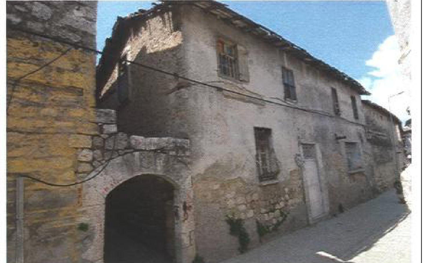
After the February 2023 earthquakes the building, which stood within the Antakya Urban Conservation Area, collapsed entirely, and its debris was sorted and removed from the site. The work therefore does not constitute a damage assessment in the conventional sense: it was conceived as a condition assessment focused on documenting the traces surviving at foundation level rather than any standing architectural elements. The spatial organisation, plan scheme and original architectural features of the building were reread and recorded by assessing together the foundation traces, the material remains identified in the debris field, oral history studies and written and visual archival documents. The aim was thus to document systematically the material and documentary traces of a cultural property that no longer exists.
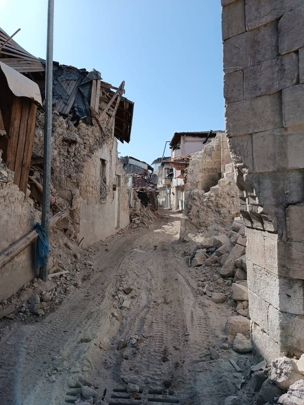
BasisVenice Charter art. 16 · Law No. 2863 · Regional Conservation Board notification
Measured Survey — Excavation Survey
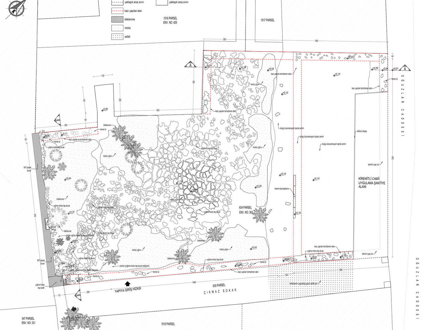
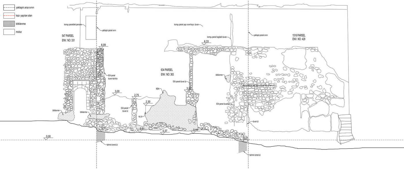
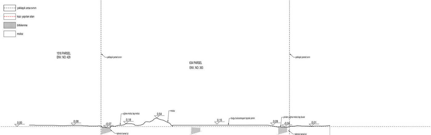
As the building had collapsed completely, an excavation survey was carried out instead of a measured survey. The debris was removed under control, and the architectural data revealed in each layer was measured and photographed before removal continued.
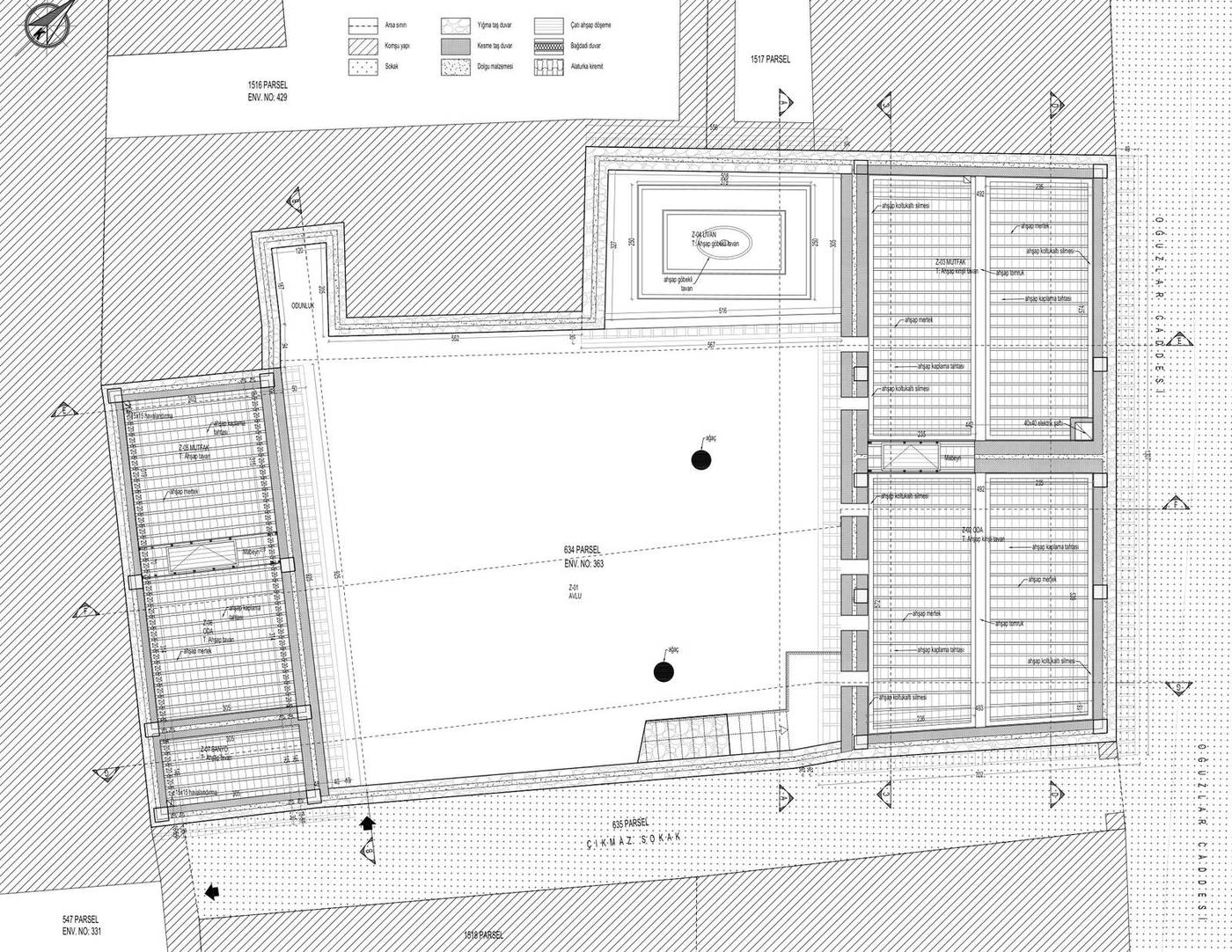
The excavation plan and sections show separately the remains of the collapsed rubble-stone walls, the wall surfaces still standing on neighbouring parcels, the areas of vegetation growth and the inferred foundation traces. Ground where no finds were made is marked with the same care, so that the limits of the record are set out transparently.
Drawings from the excavation survey sheet that describe this stage
BasisVenice Charter art. 16 · Charter for the Protection of the Archaeological Heritage
Restitution
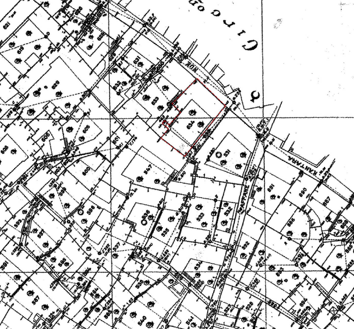
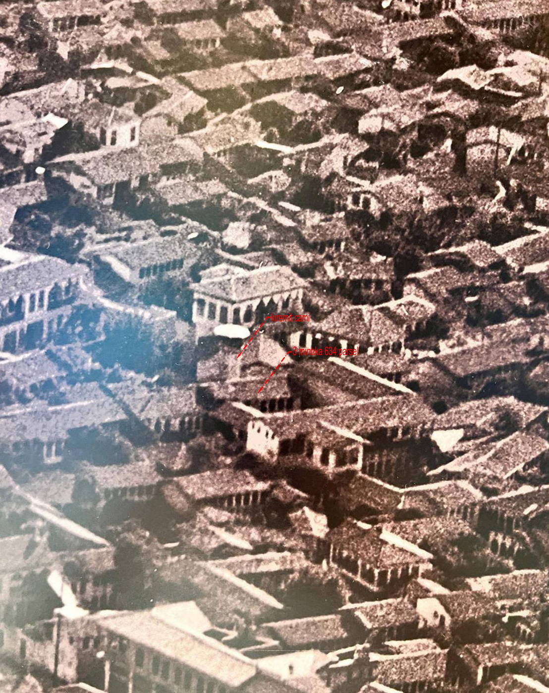
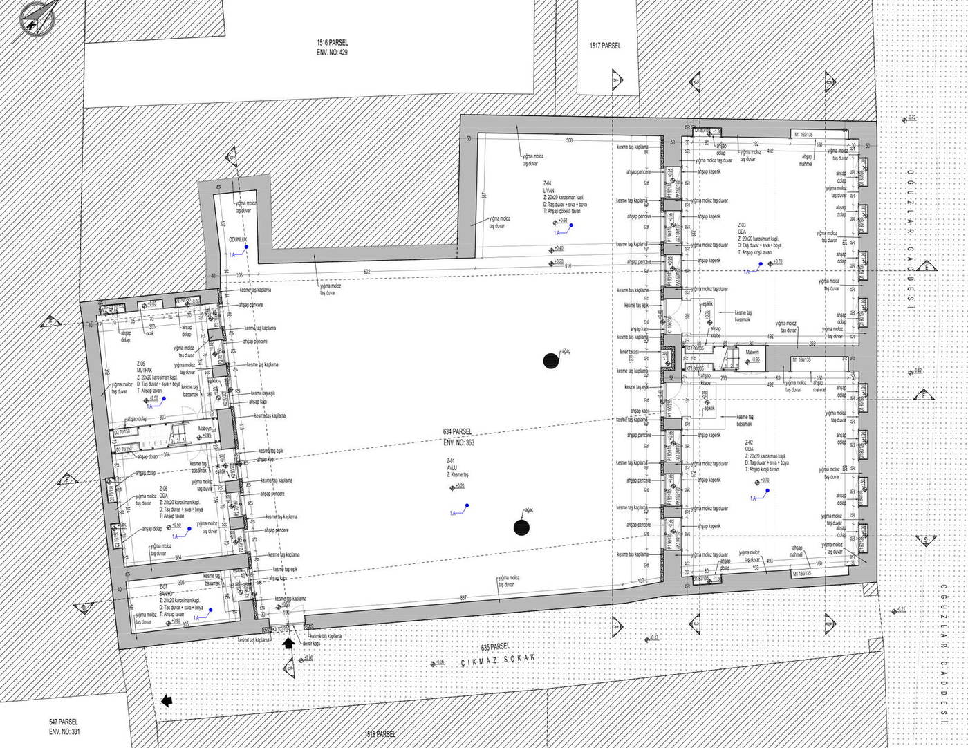
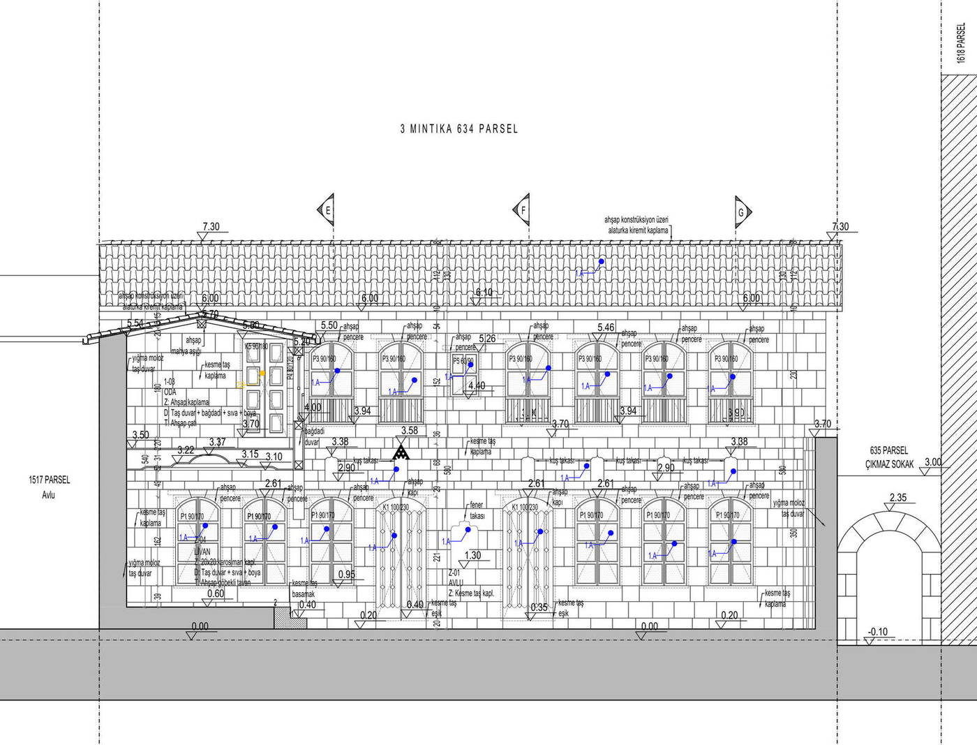
Restitution is the evidence-based reconstruction of the building’s original state before its collapse. On this parcel the work rests on the 1929 Ville d’Antioche cadastral sheet, photographs of the courtyard and street taken before the earthquake, the roof layout read from a historic aerial photograph and an oral history study.
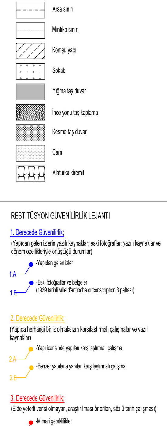
On the sheet, every restitution decision is marked against a three-level reliability legend: decisions confirmed by traces in the building and by period documents are shown as first degree, those based on comparative study of similar buildings as second degree, and those for which there is insufficient data and which remain proposals as third degree. It therefore stays legible on the drawing which information rests on evidence and which on interpretation.
Plan and elevation decisions from the restitution sheet
BasisVenice Charter art. 9–13 · Nara Document on Authenticity
Restoration Decisions
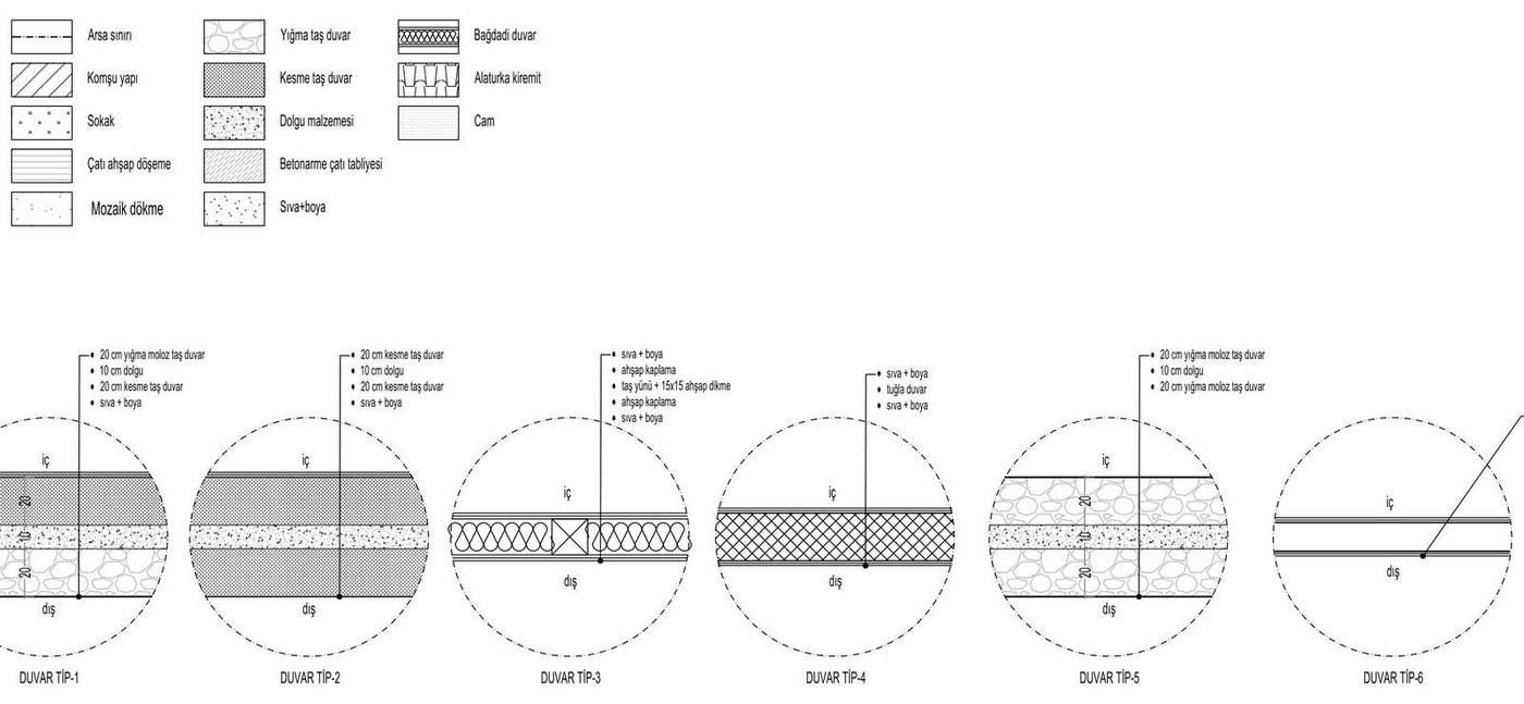
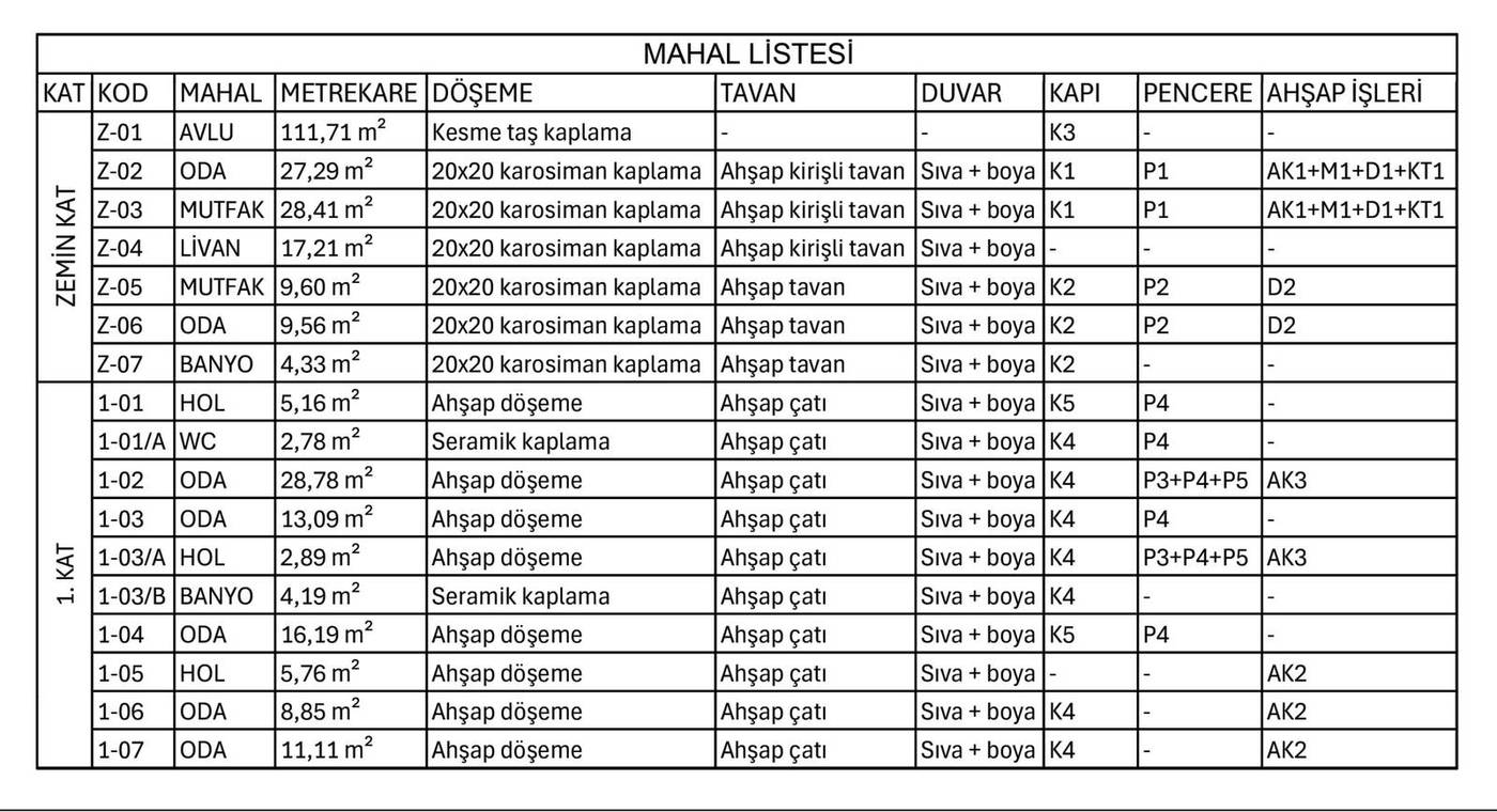
As the building was no longer standing, the conservation decisions turned towards defining the original qualities of the building to be rebuilt rather than intervening in existing fabric. The walls were defined as a three-layer stone section and the internal partitions as bağdadi lath-and-plaster; the courtyard was determined as ashlar paving, the ground floor rooms as 20×20 cement tiles with timber-beamed ceilings, and the upper floor as timber flooring beneath a timber roof.
Material and construction-system decisions
BasisVenice Charter art. 9–12 · Law No. 2863
Reconstruction
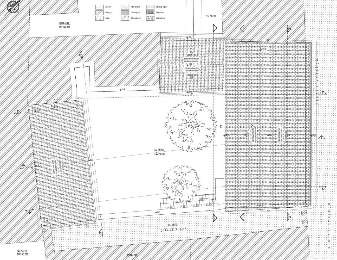
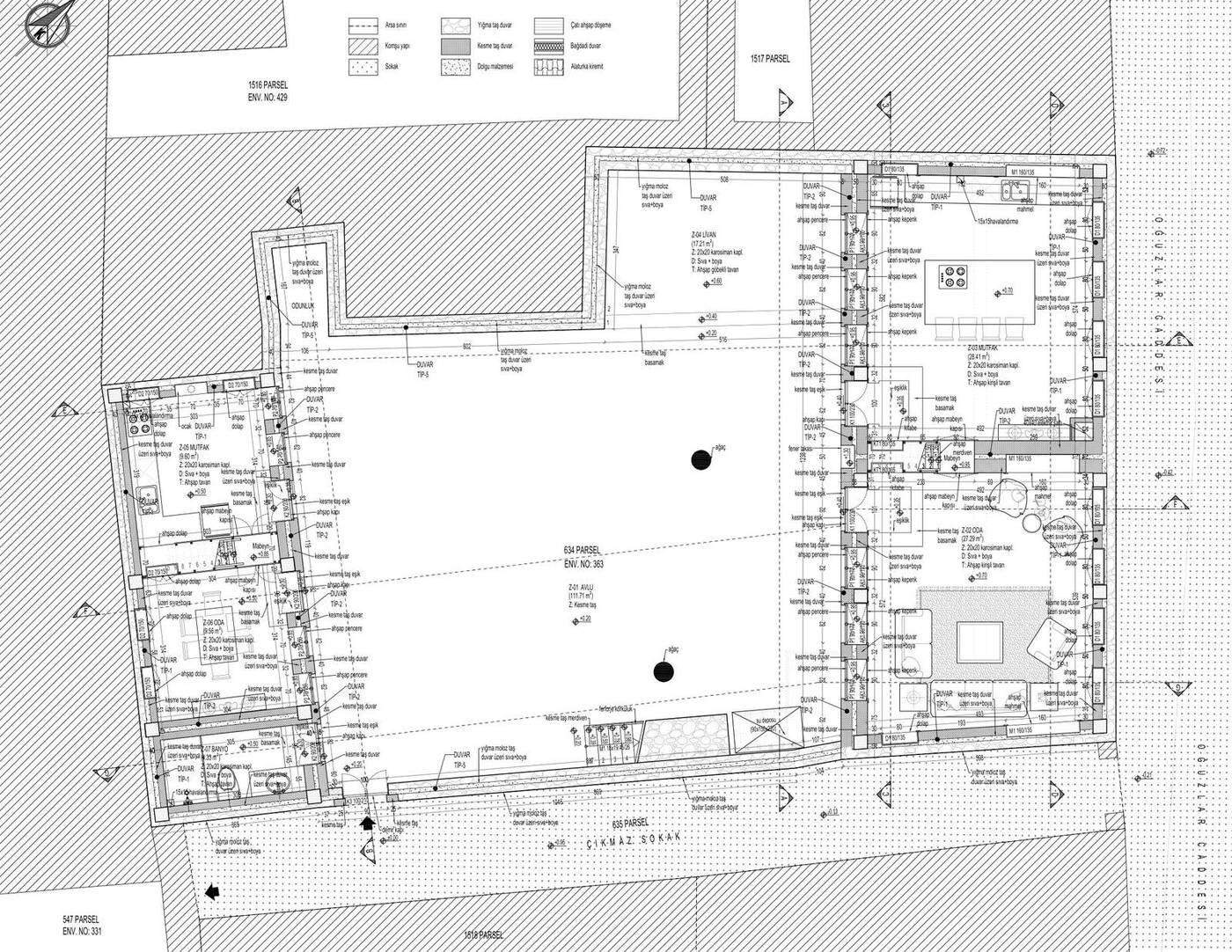
The reconstruction project defines the rebuilding of the original configuration established in the restitution, together with current building-safety requirements. The ground floor — a 112 m² stone courtyard, the liwan, two rooms, two kitchens and service spaces — and the upper floor of five rooms and halls have been rebuilt in keeping with the original plan scheme.
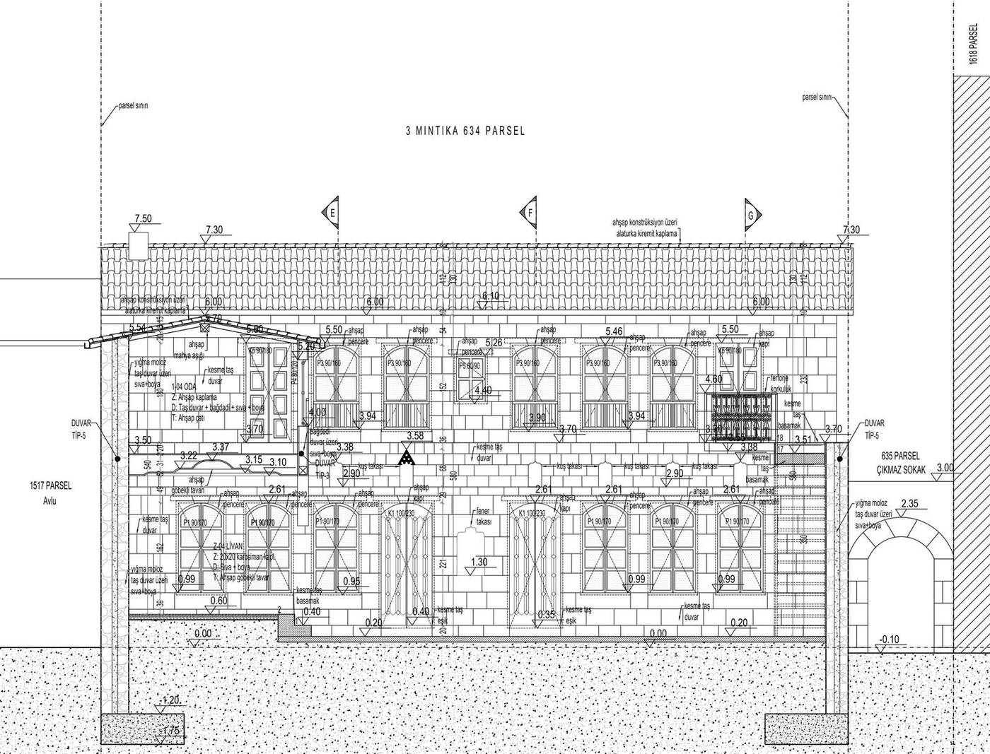
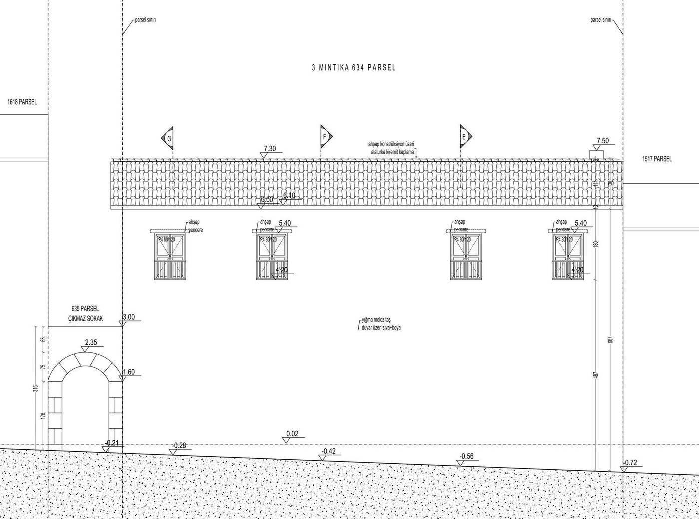
The blank stone elevations facing the two streets, the arched courtyard gate and the arched openings turned towards the courtyard have been redefined with their original dimensions, and the hipped roof built with its original pitch and eaves arrangement. The northeast and southeast elevation silhouettes show the building’s place in the street silhouette together with the neighbouring parcels.
Elevations and sections from the reconstruction sheet
BasisVenice Charter art. 15 · Riga Charter · Regional Conservation Board approval
Construction and Supervision
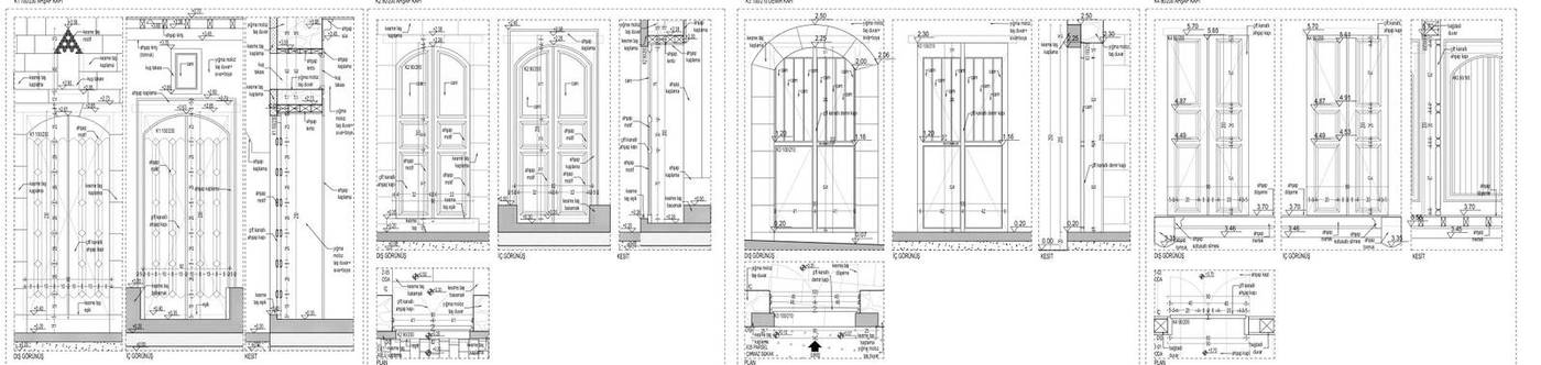
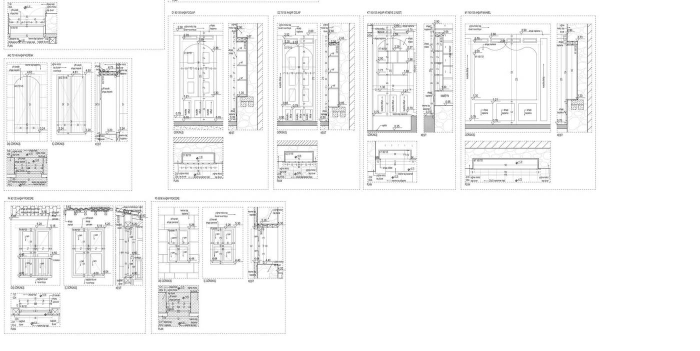
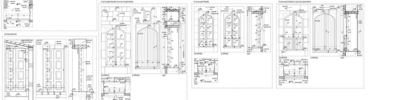
The construction stage is the process of producing the exact counterpart of the approved project on site. Door, window, built-in cupboard and shutter details were drawn at working scale, and the frame, sill and stone-wall junction details of the timber joinery were defined individually.
Traditional construction details at working scale
BasisVenice Charter art. 16 · Construction supervision and archiving
Typology of Building Elements
Liwan — The Iwan Opening onto the Courtyard
The liwan is the most defining element of the Antakya house: a semi-open space enclosed on three sides and opening fully onto the courtyard. In this building the 17 m² liwan, with its arched opening, forms the focus of the courtyard; in summer it is used for sitting and dining, and in winter it forms a threshold between courtyard and interior.
Arched Stone Courtyard Gate
The only element that establishes a relationship between street and house is the entrance door in the thick, blank courtyard wall. On the Oğuzlar Caddesi elevation this opening is framed in ashlar and spanned by a semicircular arch. The door leads directly into the courtyard.
Arched Timber Windows
The windows facing the courtyard are timber units spanned by an arch above, with the arched tympanum divided into small panes. Smaller and framed in ashlar on the ground floor, the openings widen on the upper floor and set the rhythm of the courtyard elevation.
Timber-Beamed Ceiling
The ground floor rooms are covered by timber-beamed ceilings, with the beams and the boarding between them left exposed. On the upper floor the rooms sit directly beneath the timber roof, and the ceiling is read together with the roof structure.
The Courtyard — Centre of the House
The 112 m² ashlar-paved courtyard is unquestionably the centre of the building. The liwan, the rooms, two kitchens and the service spaces all open onto this void, and the upper floor is reached from it as well. Through the long summer, much of daily life is spent here.
Stone Masonry and Bağdadi Lath-and-Plaster
The walls are built as a three-layer section of 20 cm rubble-stone masonry, 10 cm fill and 20 cm ashlar, while the internal partitions use a bağdadi lath-and-plaster system between timber studs. The ground floor carries the weight of stone, the upper floor the lightness of timber.
Project Sheets
Excavation Survey Sheets
Scaled documentation of the traces revealed during debris removal
- EXCAVATION PLAN
- SECTION AA
- SECTION BB
- CADASTRAL SITUATION
- SITE PLAN
- LICENSED SURVEY (LİHKAB) BOUNDARY
Restitution — Plans
Evidence-based redrawing of the building’s original spatial organisation
- GROUND FLOOR PLAN
- FIRST FLOOR PLAN
- GROUND FLOOR STRUCTURE PLAN
- FIRST FLOOR STRUCTURE PLAN
- GROUND FLOOR CEILING PLAN
- FIRST FLOOR CEILING PLAN
- ROOF PLAN
- 1929 FRENCH SHEET
- HISTORIC AERIAL PHOTOGRAPH
- RELIABILITY LEGEND
- CADASTRAL SITUATION
- SITE PLAN
- LICENSED SURVEY (LİHKAB) BOUNDARY
Restitution — Elevations and Sections
The facade order onto two streets and the vertical organisation facing the courtyard
- OĞUZLAR CADDESİ ELEVATION
- CUL-DE-SAC ELEVATION
- SECTION AA
- SECTION BB
- SECTION CC
- SECTION DD
- SECTION EE
- SECTION FF
- SECTION GG
- NORTHEAST ELEVATION SILHOUETTE
- SOUTHEAST ELEVATION SILHOUETTE
Restitution — Architectural Details
Documenting doors, windows, cupboards and timber elements
- DOOR DETAILS
- WINDOW DETAILS
- CUPBOARD AND JOINERY DETAILS
Reconstruction — Plans
The plan level of the document-based rebuilding decisions
- GROUND FLOOR PLAN
- FIRST FLOOR PLAN
- GROUND FLOOR STRUCTURE PLAN
- FIRST FLOOR STRUCTURE PLAN
- GROUND FLOOR CEILING PLAN
- FIRST FLOOR CEILING PLAN
- ROOF PLAN
- ROOM SCHEDULE
- WALL TYPES
- CADASTRAL SITUATION
- SITE PLAN
- LICENSED SURVEY (LİHKAB) BOUNDARY
Reconstruction — Elevations and Sections
Re-establishing the original envelope, the liwan and the courtyard elevation
- SECTION AA
- OĞUZLAR CADDESİ ELEVATION
- CUL-DE-SAC ELEVATION
- SECTION BB
- SECTION CC
- SECTION DD
- SECTION EE
- SECTION FF
- SECTION GG
- NORTHEAST ELEVATION SILHOUETTE
- SOUTHEAST ELEVATION SILHOUETTE
Project Team
- Yonca Yılmaz Çelebi
M.Arch · Conservation Specialist - Burcu Özlüoğlu
Architect - Eda Yabancı
Conservator
Method and Sources
The sequence followed in this file — documentation, diagnosis, evidence-based restitution, repair with minimum intervention — is the established method of the conservation literature. Intervention decisions were taken on the principles that repair must not begin before the cause of damage has been diagnosed, and that the degree of intervention rises from consolidation towards reconstruction only as far as necessity requires. For the theoretical framework see Zeynep Ahunbay, Tarihi Çevre Koruma ve Restorasyon (YEM Yayın, 2009); for the principles, the Venice Charter (1964), the Nara Document on Authenticity (1994) and Turkish Law No. 2863 on the Conservation of Cultural and Natural Property.
Services applied in this project
Related projects
View the project in presentation format
The submitted drawings, process account and typology cards for this parcel are available at full resolution in the horizontal presentation on the site.